
All photos in this post by Peter Kabaila
42
Underestimated and Under threat – The Best of the Snowies on Foot
5-6/12/15
Snowy Mountains
Hiking
The first part of the trail was a fire road. Used to be a public road. Dad had driven my brothers and I almost to the very top of Kosciuszko in the early 60’s. We walked up the same road, now closed to all but walkers, cyclists, skiers and Parks people. Gently uphill. The packs settled in to our shoulders. Chris was on his first overnight walk for decades. The other six of us had more recent experience with the loads on our backs. In August 1985 Stephen Crean, the brother of politician Simon, had disappeared somewhere along this section while skiing from Charlottes Pass to Thredbo. Wild stories postulated his fate until his remains were found by chance a long time later.
At the Snowy River crossing we rested and refilled water bottles. Here it is a small stream bubbling between granite boulders and fields of alpine plants. In one sweep you can take in its entire catchment in the shallow plateaued hollow bounded by the Ramshead, Etheridge and Stillwell ranges of small rocky peaks near the top of Australia. From here it builds before waterfalling and rushing down to be met by Spencers Creek before it hits the wall at Guthega Dam. Downstream of the dam it becomes a tale of wild river tamed, contained, dammed and shut in and redirected by “development”. The Snowy Scheme uses the water for hydro power before sending it through to the west side of the mountains for irrigation. Now the fight is on for the reestablishment of environmental flows to be released into the original river system to reinvigorate its health. 2% of its original water for one of the country’s wildest rivers just isn’t enough. Our “development” stretches deeper even than this in the current attempt to offset climate change by cloud seeding to increase diminishing winter snowfall.

 As we ascended the next steeper section the horizon extended with vistas in all directions. The Snowy River valley meandered northwards, the Main Range mountains lined up in the west and the Monaro Plains blued the distant east. At Seamans Hut another rest, a breather this time. Laurie Seaman had perished here in a blizzard in 1928 and his mate Evan Hayes not far away. Seaman’s parents sponsored the building of the shelter hut. In the big snow year of 1980 Cath and I had brought crampons, an ice axe and all our toughest gear for an attempt to cross the main range in winter. We camped in the lee of the hut as atrocious weather struck. In the early evening a bedraggled group of scouts arrived at the hut with tales of a leader and another scout lost up higher near Rawsons Pass. The wind overnight pummelled our Antarctic strength tunnel tent nearly flat. We abandoned our trip and skied out at first light to raise the alarm and initiate a rescue. Turned out they were from WA and very ill prepared.
From Seamans Hut the trail climbs and winds round the edge of the Etheridge Range. I looked across the cliffed eastern slopes into the sheltered areas where four snowboarders had died in 1999. They were experienced in the mountains and established a high snowcave from where they intended to access some of the best untracked terrain in Australia. A huge dump of snow caught them unawares in the night. Wind from the southwest blew masses of powder snow over the range which then accumulated and settled on the lee side right on top of their base camp. The snow sealed off their ventilation as they slept and then asphyxiated. Their bodies were not found until the spring thaw. I’d had a school group out in a similar situation in a sheltered place below a ridge. Massive snowfall settled on our tents and in the night I got up three times to dig them free of the 90cm of powder that built over us. One of our walking party, Peter, had a narrow escape that night having dug himself out of his own snowcave as I made my first round from tent to tent with the snow shovel. We had embraced and thanked his lucky stars in the midst of the maelstrom.
At Rawsons Pass we rested again and refuelled. Peter connected up with some Asian tourists. Mountainbikers parked their bikes. The trek to the summit became crowded. A long distance trail runner sweated past. Mount Kosciuszko is one of the world’s Seven Summits – the highest mountains on each continent. To climb these Seven Summits is a massive undertaking and was quite an achievement for the first successful mountaineers. The danger and challenge has not diminished but commercialisation has widened the number and capabilities of people attempting it. Guiding companies can even take clients to the top of Everest and Denali for the appropriate fee ($60,000US for Everest). I have tried to take student groups cross country skiing up Kosciuszko a couple of times but never managed the summit even though it is only 6km from the Thredbo chairlift top station. The snow is always icy, the weather often not good. The last aborted attempt was due to deteriorating conditions and a forecast blizzard later in the day. We saw a party of Japanese mountaineers setting off for the summit that day as we pulled the pin and headed back down. As the storm developed we heard that they had been trying their seventh and last summit on the list, and the lowest. They had been advised not to go that day but had time constraints with connecting transport and flights so had not heeded the advice of their guiding company. Apparently they did not make it and needed a full scale National Parks, SES and Police Rescue team to bring them back to safety.
The weather for us was perfect. Clear and warm but not hot. The wild blue yonder of the western slopes and Victoria came into view as we circled up to the big cairn on top. Chris had never been there before so the obligatory photos were taken and sent to his family back in Canberra. The scene with snowdrifts, rocky outcrops, peaks and dramatic cloudscapes was straight out of the famous Eugene Von Gerard painting from centuries prior. Distant Mount Jagungal beckoned in the north.
One of the best sections of our route, now on a walking path rather than fire road, was from Kosciuszko north towards Lake Albina and Muellers Pass. The track descends a narrow ridge with deep valleys on either side. Less of the tourist walkers take this track around the Lakes Walk. At a lookout rock I spied two brumbies at the bottom of the valley to the east below Rawsons Pass. Two sleek black horses strolled at ease, grazing. I felt conflicted between the colonial patriotism of “The Man From Snowy River” and all it stands for.  Wild horses running free through the high country. Stockmen galloping after them. Chasing the country’s rural heritage which is so much part of our national psyche. A connection with The Bush and our rural past that many of us hanker for. Later that day we would camp in a sublime hanging grove of streams and delicate cushion plants and alpine bog – the areas so fragile under the brumbies’ hooves. The horses were grazing in the vicinity of the old Kunama Lodge which was part of one of the earliest ski tows for adventurous skiers on the main range. It operated in the early 50’s until an avalanche swept away the hut and killed Roslyn Twynam Wesche in 1956. The hut, tow facilities and nearby stockmans huts have all been since removed. Similarly Lake Albina Lodge and the Soil Conservation huts have also been removed from the Main Range area.
Stone paved steps led past rocky outcrops and above large snowdrifts. After Muellers Pass the track was dug into very steep slopes and we sidled across the side of Mount Northcote. Lake Albina perched on our left in a stunning glacial valley that plunged deep into Lady Northcotes Canyon. We had struggled down and back up out of there from Watsons Crags years before. Steep and treacherous country. Across Lake Albina rose Mount Townsend, probably the best of the highest mountains. It is a real peak, isolated, rocky, steep and imposing. This was the mountain Prabhdeep Srawn was heading for in 2013 before he disappeared. Extensive searches since have not yet found any trace of him and the coroner has ruled that he most likely died in the mountains.
 Traversing Mount Northcote is one of the major challenges on a winter crossing of the Main Range. It is steep on all sides and being exposed to the worst of the weather is nearly always covered in a veneer of wind blasted ice. I have made it across twice. The first time my mountaineering experienced brother cut steps across the steeps with an ice axe so we could walk and carry our non metal edged skis. Even this was scary as any slip would end several hundred meters below. On the second time I was a better skier and tracked across on metal edges with a heavy pack. Until the edges caught a sastrugi bump and I skittered off downhill at accelerating pace towards the rocks and frozen lake below. I managed to twist over onto my stomach and grab the tip of one ski pole which I forced into the ice. Luckily the point dug in and I slowed to a stop. Mt buddy now high above could not do anything. I had very tentatively stood up again on the edges and stepped up and across to the saddle with no confidence and with great fear. Our view over lunch of blue ranges and plain lands to the west was framed with Mt. Townsend and Watsons Crags. Spectacular.
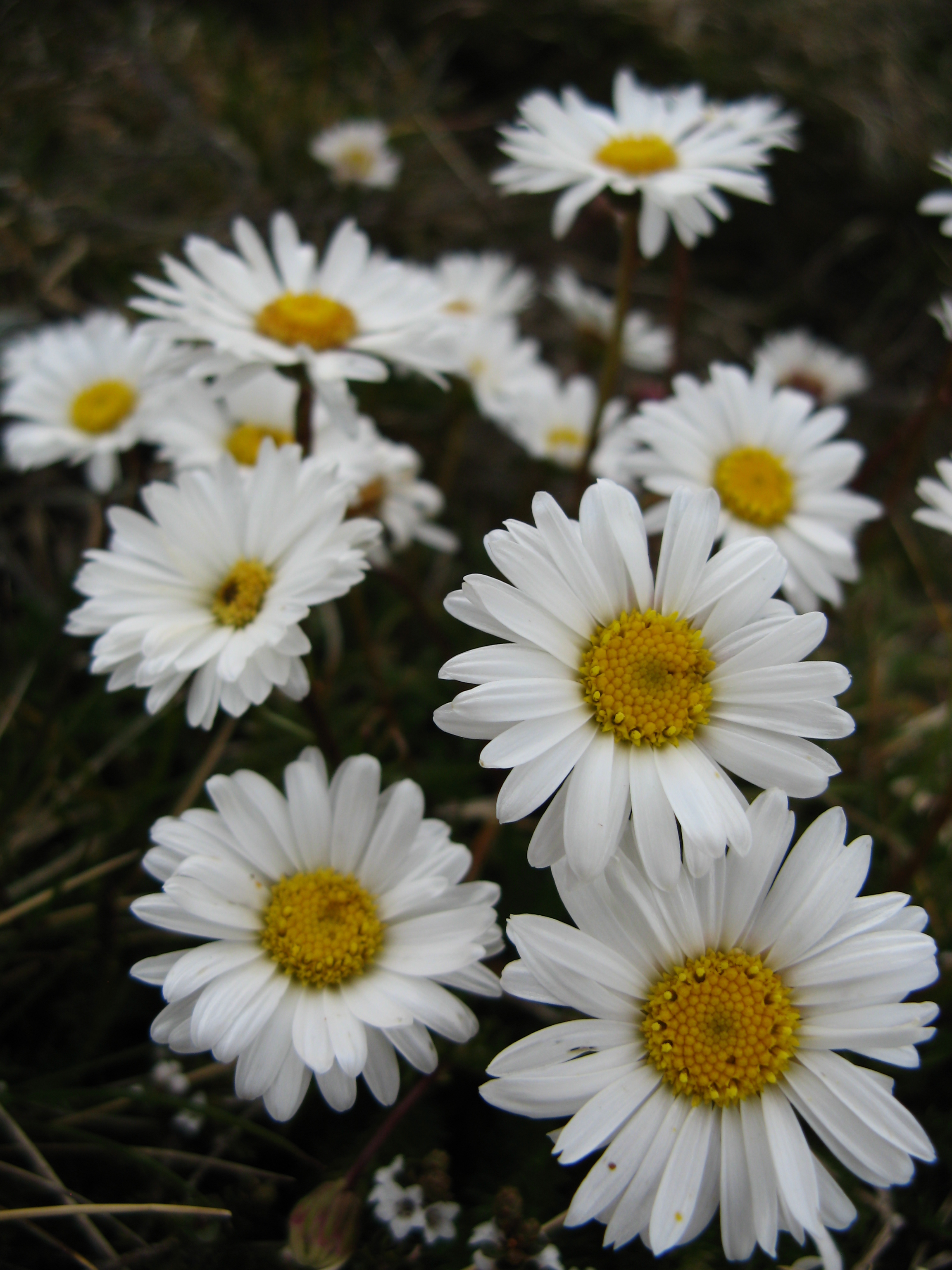
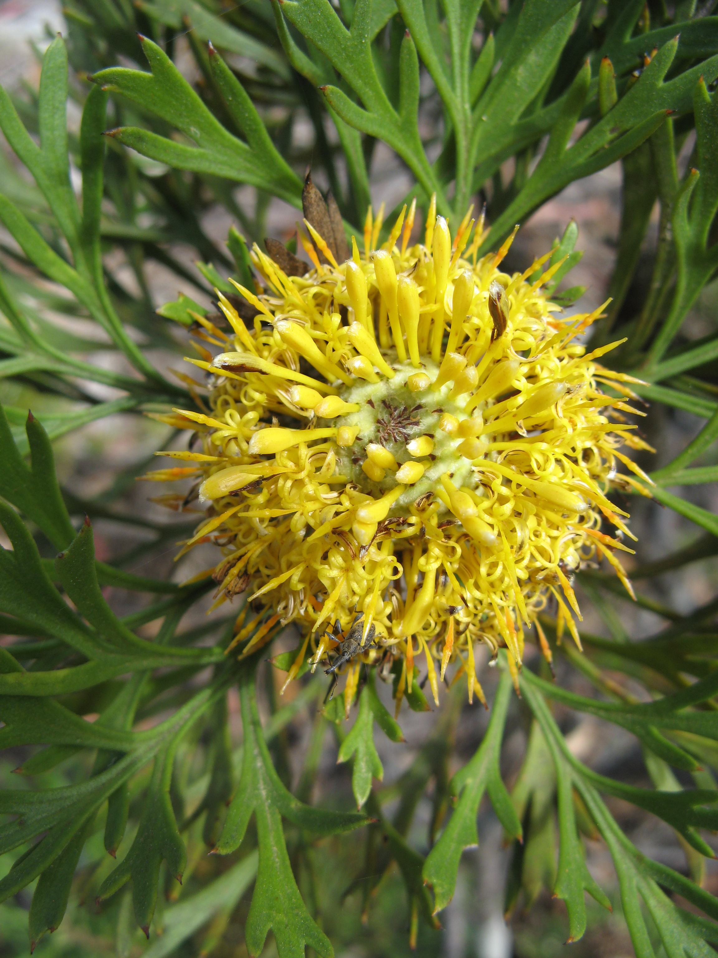
People in the group chatted in pairs or trudged solitarily up to the top of Mount Carruthers. This is a rounded hill but is in a fine position among the steepest parts of the range. Club Lake was far below. A few large snowdrifts remained in the shadier slopes. Hardy micro alpine plants and flowers grew in stony areas over these hilltops and ridges. “How much further to Go?” The harder part of the day was upon us. Tired. Sore shoulders. Running low on water.
We skirted the top of Blue Lake. We had experienced multiple wild nights camped down there in winter. The nights always seem to be the worst. My brother had spent 5 days huddled in the squalid emergency basement of the Soil Conservation Hut in an endless blizzard. Before the time of mobile phones we just had to sit it out at home waiting for word from him which eventually came through. Another time a friend had work commitments so tried to ski out in a whiteout and managed to ski in a complete circle, luckily ending up back at our camp 3 hours later. The cliffs and gullies that lead down to the lake were well below our track across the tops. In 2008 Tom Carr-Boyd was skiing along an ice cornice in this area. His brother below noticed that he was in a dangerous situation and yelled at him to move back. In trying to get back from the edge the overhanging ice broke and avalanched Tom to his death below.
Jerry left us on the final climb of the day up Mount Twynam and rejoined the Lakes Walk trail back to Charlottes Pass. The view back towards Kosciuszko from Twynam was full of Von Gerard cloud drama, rocky foreground, snowdrifted peaks and dark green valleys.
 We romped down snowgrass meadows and rock slabs to our camp in a small hanging glaciated cirque below the summit dome of Twynam. This place reminds me of stunning photos of Sierra Nevada landscapes. Granite cliffs formed a backdrop. Two streams fed by large snowdrifts tumbled over boulders and small falls to flow more slowly across our enclosed flats. Soft plants and patches of coloured wildflowers carpeted the floor. Camp was set up on a flat soft space between rocky bluffs and a creek. Peter and Amanda camped out further at the edge where the ground dropped away to the valley and the main stream flowed downwards. Our tents added more colour to the alpine mountain scene. The landscape encouraged a relaxed afternoon tea taking it all in then exploration. Bob followed a stream up to a waterfall. Chris found a high rock vantage point. Cath stretched beside the creek. I climbed the easy angled rock and snow slopes. Peter took photos. The place had a pristine magical feel. Cosy, intricate, untouched. A hidden gem among the grand peaks of the Main Range.
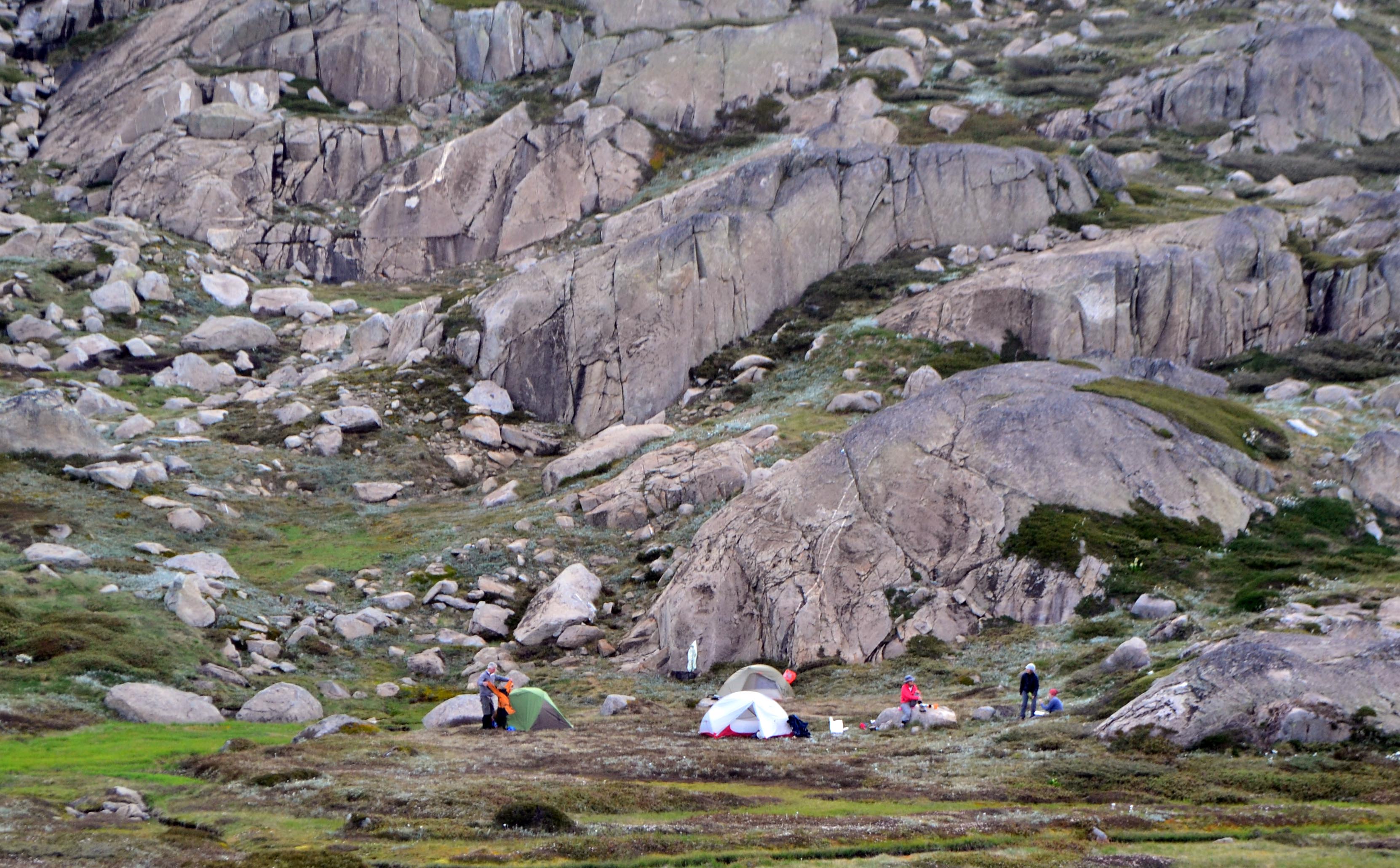
Overnight the dark blanket of sky was heavy with stars. In the morning the alpenglow pinked then yellowed before the dawn. Breakfast as the sun rose. We were all reluctant to leave.
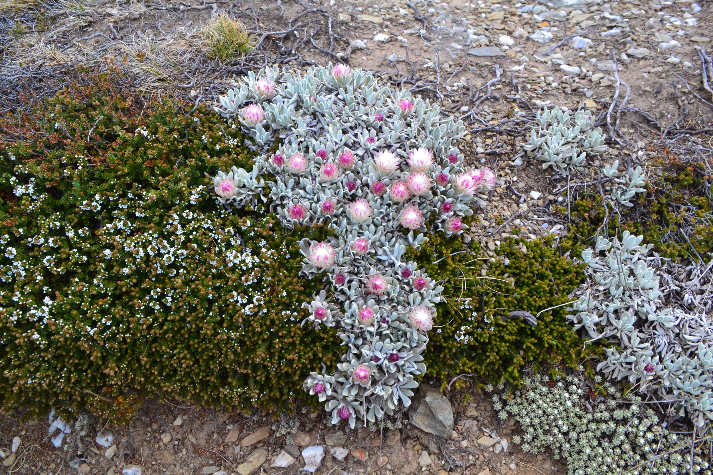
 Off the main route we picked up the faint path of the Australian Alps Walking Track. Along the spine of the range we passed Mount Anton then climbed Mount Anderson and traversed below Mann Bluff. The flowers across this section were the best we had seen. Still a little before their prime they patchworked the meadows in sprays of white and yellow and pink. Everywhere you looked was a scene from the “Sound of Music”. Steep, deep valleys fell away on the left and on the right was the Snowy River way below and on its far bank the hills rose to the ski slopes of Perisher Blue. Occasional bits of wire and fence posts were the only reminders to our untrained eyes that this used to be grazing land before it was national park. Amanda peak bagged Mount Tate over an early lunch. From here the route of the whole hike was laid out. It seemed like a long way. This two day combination of linked up trails must be one of the best walks in Australia and the equivalent of any hike in the world.
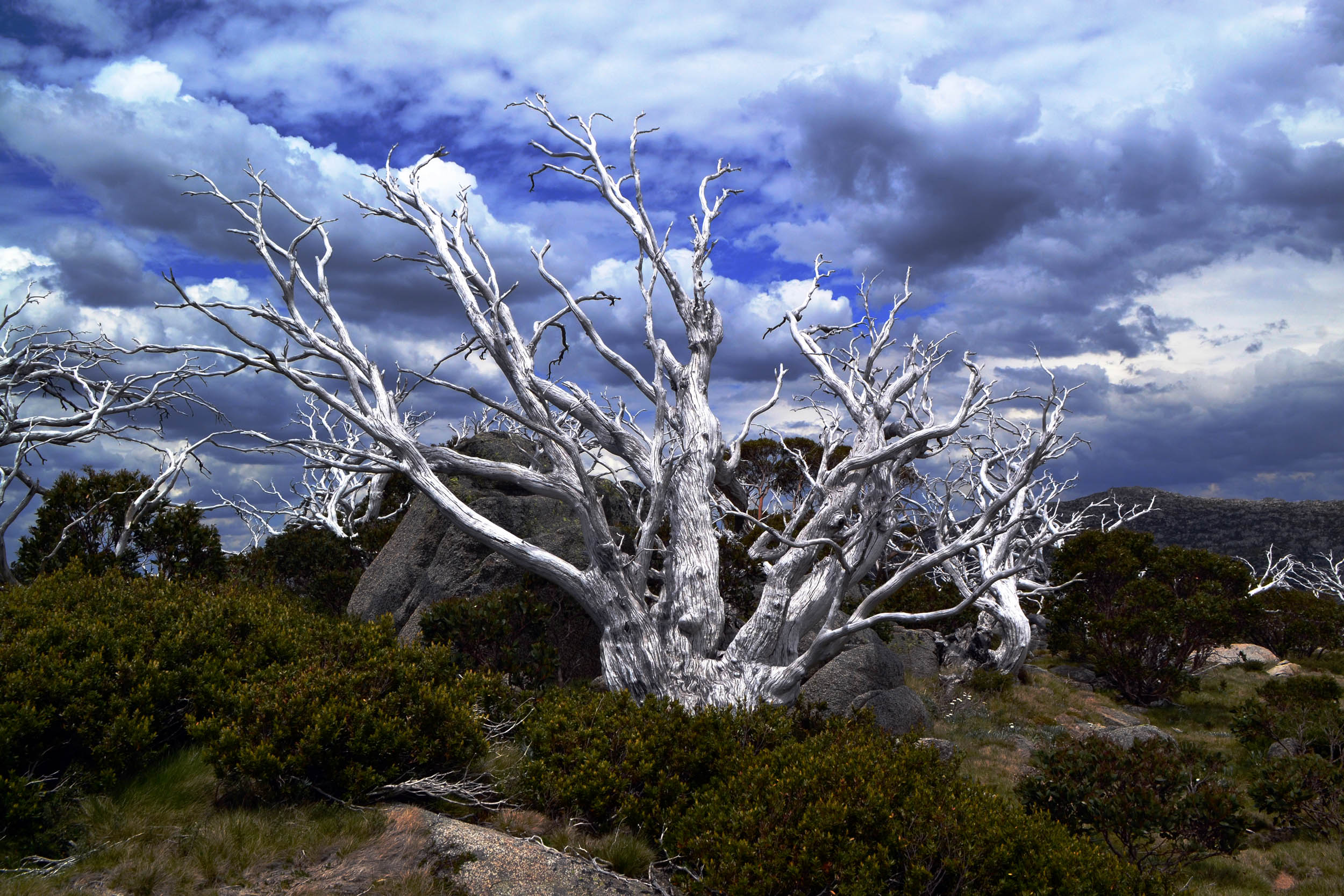
At Consett Stephen Pass it became clear to some of us that there was still several kilometres to walk. We climbed to a high point east of the pass then headed across open snowgrass country to the south east. The pace slowed and the group quietened. Eventually we found the start of a faint track that took us down a ridge towards Guthega Dam. Through more patches of wildflowers among eerie snowgum tree skeletons from a previous fire. Half way down we rested. This was the tough bit for some. Sore shoulders, dodgy knees hurting, tired, thought we would have been finished by now, getting hot. Chris had hit the wall (he told us later) but pushed stoically onwards.
 Crossing the dam wall thrust us back into development and civilisation with a thump. Slow steps up the final hill to the car.
Coffee, pastries, pies at the bakery in Jindabyne. The simple pleasures of finishing a demanding hike. Everything had gone like clockwork. Our bodies had held up. This had been a short but very rich experience, a classic journey taking in the best of the Snowy Mountains. Safe. The weather had been delightfully kind – calm and cool.
Day 1 – Charlottes Pass to Seamans Hut to Rawsons Pass to summit of Mount Kosciuszko to Mount Carruthers (at this point the Lakes Walk branches off) to Mount Twynam then down to camp just to the north of Little Twynam – about 18km
Day 2 – Little Twynam camp to north east ridge of Twynam then Mount Anton to Mount Anderson to Mann Bluff to Mount Tate to Consett Stephen Pass then down the long ridge to Guthega Dam and up to Guthega Village – about 14km

 e than a hundred over the years and Ray who must have done way more than this even. It was a trail we had done recently and I’d done several times before. It was remote but had a decent track and was a good distance. The route led us down a rocky spine into a delightfully cool, moist creekbed.


 Another short day on the river whitewater kayaking. The level had been holding for a while with recent rain continuing. Canberra whitewater used to be more reliable but now it’s a matter of when the river is up you need to get in the water quick. Friends, boats, paddles, we were all in. Or mostly. Caleb rolled and pirouetted and nose dived and tailied and played like a pro who had never been far from the flow. I took it easy and surfed a lot but didn’t swim this time. DanM ran all the bigger lines and surfed like there was no tomorrow in his yellow banana. And Mitch and DanG pushed themselves and surfed and drank a little water upside down. The Gopro lit up and did all the right things to capture all the action then spat the dummy and lost all the footage. Oh No! Disappointment. It would have been a ripper compilation. Oh well, we’ll have to do it all again when it rains next.
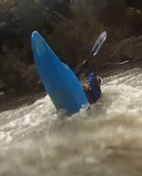

