Category Archives: Mountaineering

Mount Franklin – Arthur’s Pass New Zealand – Summer Solo

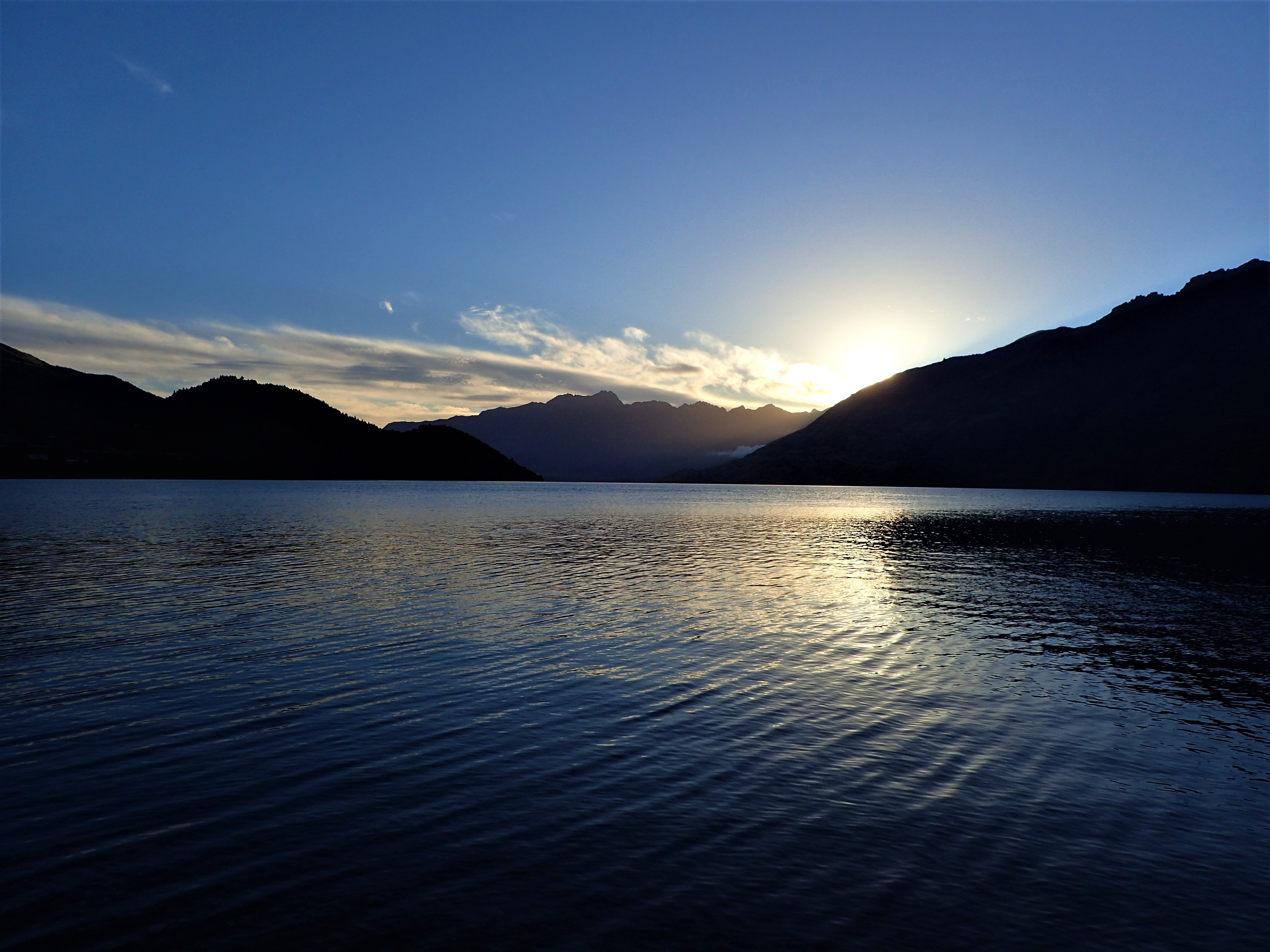
As each new stage revealed itself I considered turning back. With a comrade we would have talked through the options and continued on our way. Alone I felt with each stage I was getting deeper in and further off the beaten track. No mobile reception. The sat phone was a last resort at the bottom of my backpack.The initial hike in along the Mingha River had been pleasant. Braided stream crossings, 
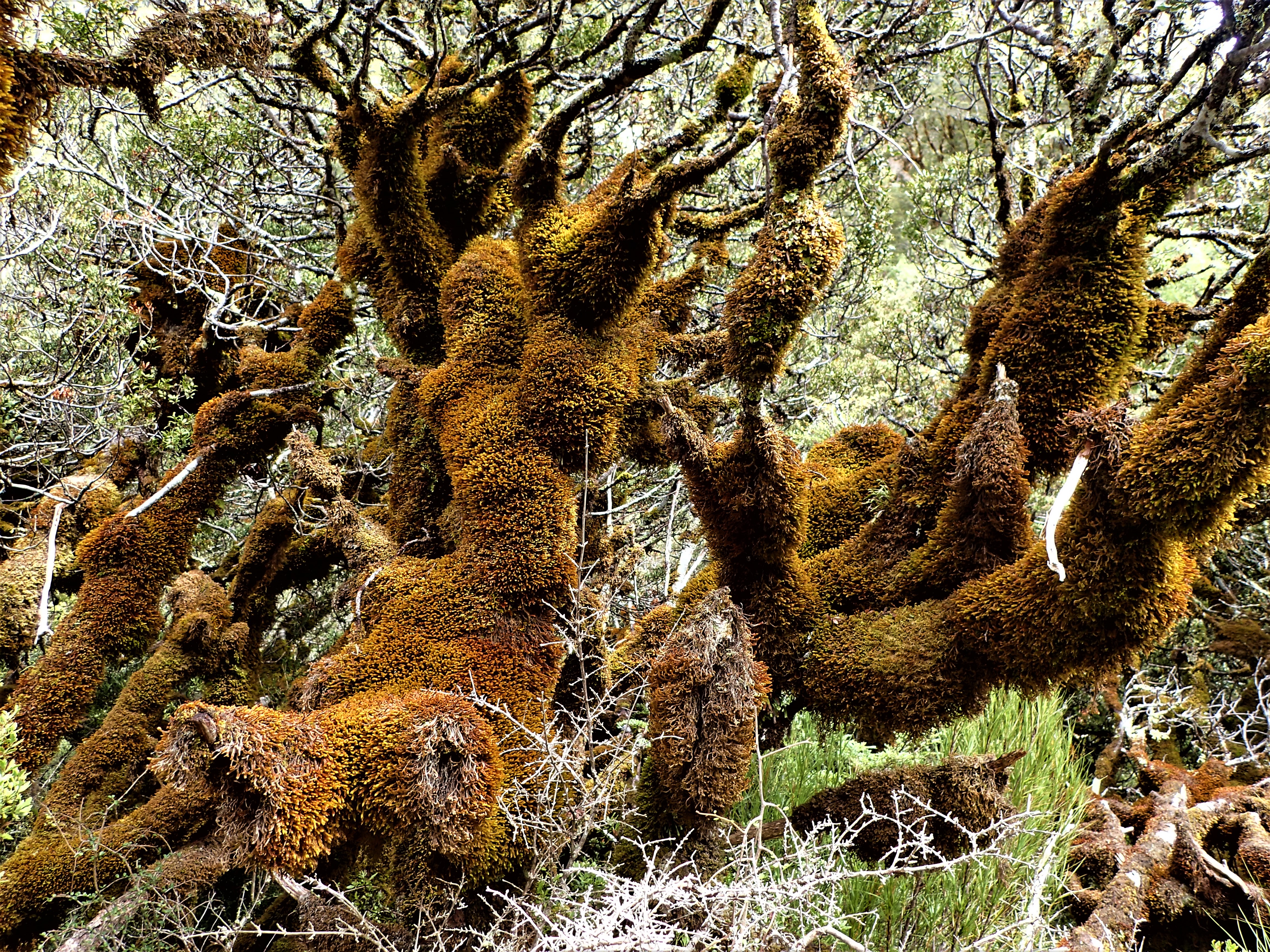
Lord Of The Rings moss forests, ferny grottos, blue pools beneath rapids and cascading glacial waters, high valley walls on either side. At times I felt like Frodo on a quest. The high point of Dudley Knob gave gorgeous views back down and up valley. Up and down over tributary streams to Mingha Bivouac which was being refurbished by a tradesman and passing hikers. There were quite a few of them. Many were hiking the Te Araroa, a trail that stretches for 3,000 km from the top of New Zealand to the bottom. Some were doing “just” the South Island and others the whole thing. My route in was  partly along the river trail of the “TA”. Most were “southbounders”, pairs, couples, solos. Kennedy Falls plunged 150m into a raging torrent below. Walking at a moderate pace, stopping to take photos and eat and drink, it took 4 hours to reach Goat Pass and the very pleasant hikers hut. Then down, following the streamway, criss-crossing to switch sides and sometimes threading the stones in the actual stream. Waterfalls tumbled from on high. Down the Upper Deception River. 
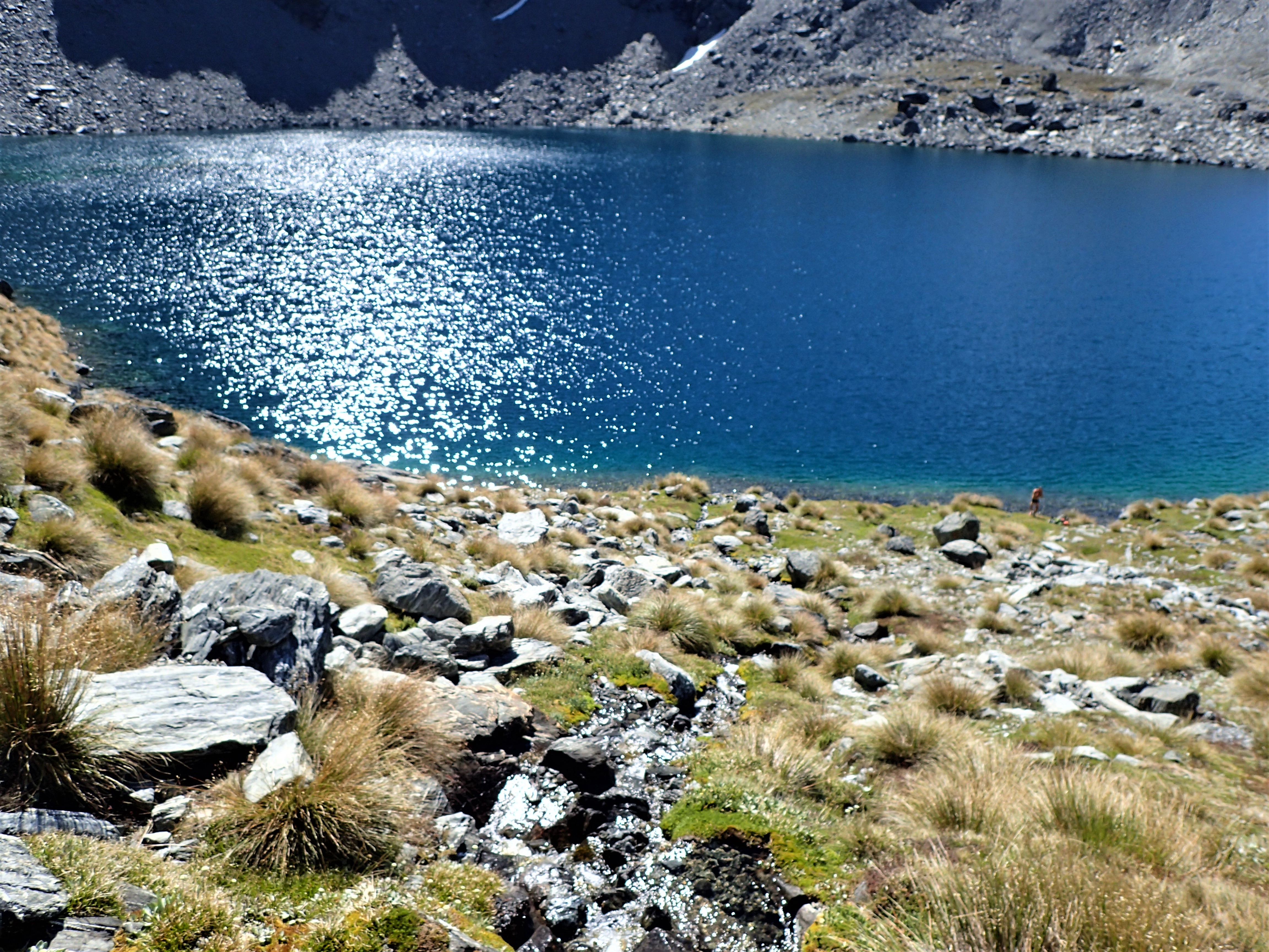
Deception Hut was true to its title, promised much and delivered nothing – hot, stuffy, full of sand flies, grotty and not even enough ground to pitch a tent outside, in a patch carved out of the bush. I had considered overnighting there but a decision was already made for me. From the later start of the day, 10.00am, it was already 4.00pm. My time estimate for the climb from the hut at 750m to a hopeful camp at Lake Anna at 1750m was about 4 hours. Give or take, a lot of unknowns.

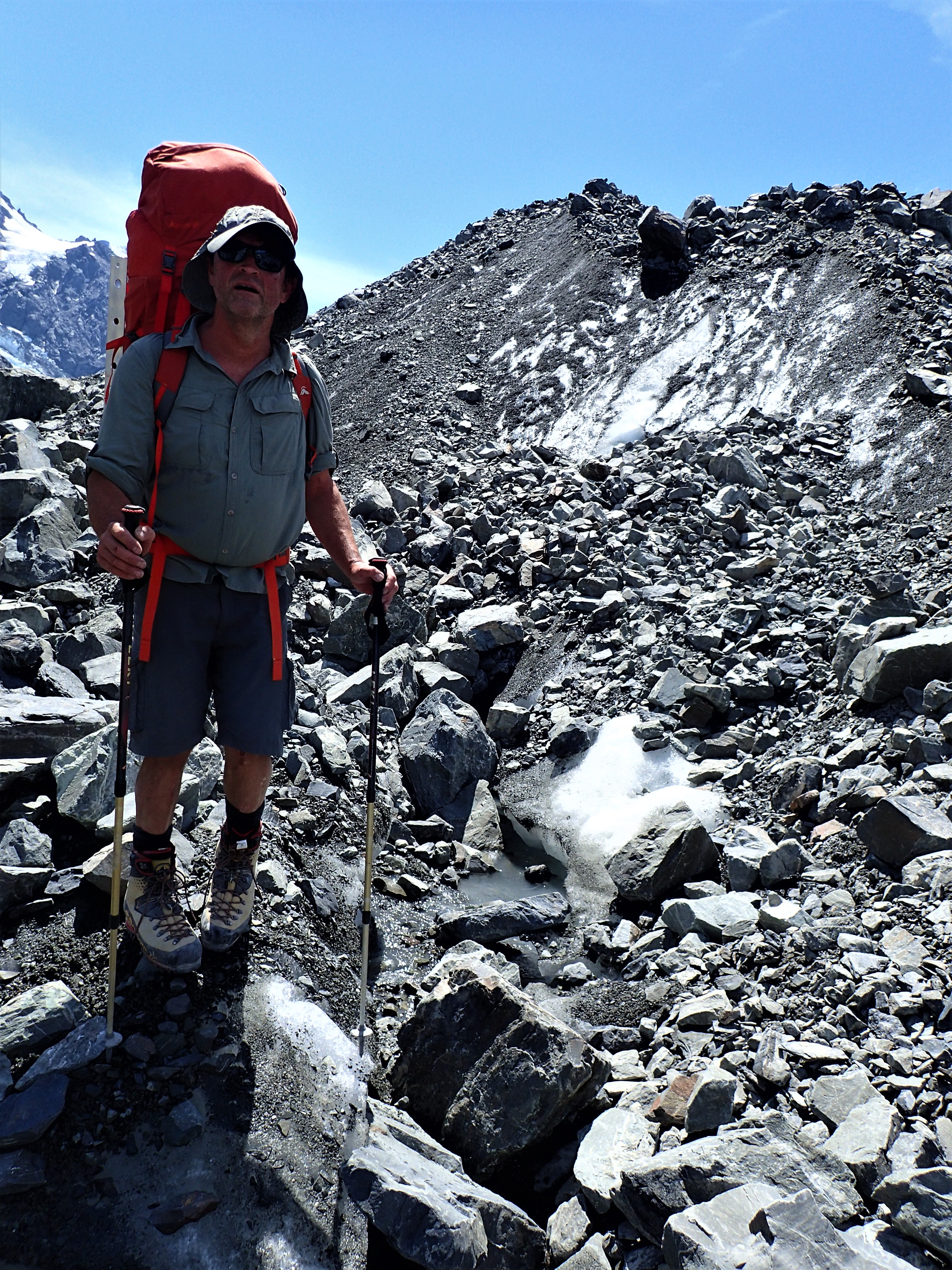
“Ascend the slide upstream of Deception Hut to the scrub line then sidle into the head of the creek” (Good Luck Creek). Guidebook brevity. I finally twigged that a “slide” was a narrow river of talus rocks that had flowed as a landslide from the crumbling cliffs way above. Previously I had learned that these possible routes through surrounding steeps were not quite as vertical as they appeared when you actually started climbing up. This one looked long and very steep, especially the top part. Stage 1. Charlie had taken a nasty tumble in this hostile sort of terrain. I spied out discontinuous runs that were partly vegetated – these stones had been stable long enough for plants to grow around them and so made reliable steps. I linked a few of these then when they ran out I took to the lines of larger rocks – these are most often more stable, but when unstable the consequences are greater. I moved to the right hand side where larger stones met the bush edge then back to the middle and then back right. Up and up. On the smaller rocks it was a matter of moving up quicker than the stones flowed down. There is mostly a strange sense of equilibrium on some “slides” where the rocks have come to rest and when they slide away they don’t go far. I guess the steeper ones, and particularly collapsing moraine walls, are often too vertical to be negotiable. As I approached a narrowing towards the top with a slight sense of vertiginous instability due to a subtle steepening of the angle I was able to crab walk gingerly across to a scrubby gully on the left.

Going any higher on the slide was not an appealing option. Stage 2. The gully was almost vertical but led to a ridge line that looked good. Large tussocks and bushes provided surprisingly secure handholds which enabled ascent. In fact they felt more reliable than some of the rock hand and footholds in the Southern Alps. At the first flattening on the ridge I found a cairn and didn’t feel so alone. A route had been taken this way by others in the past. This was reassuring and a confidence boost. Perhaps Gandalf or Strider had passed up here. The ridge led upwards to about the 1250m level where there was a vague sloping shelf that looked like it could provide access across the face of the valley wall. Stage 3. The scrub was almost impenetrable – at times I had to weave between bushes, at others just bash through, occasionally disappearing into a hole beneath the foliage. Slow. Tiring. Lifting legs up and over too high branches. This was turning out to be a true New Zealand alpine mountain struggle with a bit of everything just to get to the climb. Semblances of overgrown track appeared randomly in the scrub – bliss.

Mount Franklin above Upper Deception Stream

Eventually I could see and then finally reached the upper shelf of the creek, a beautiful stream that crescendoed over a set of falls off the edge of the scarp into an unseen void. I picked out what looked like a possible summit of Franklin above a high shelf of stone.

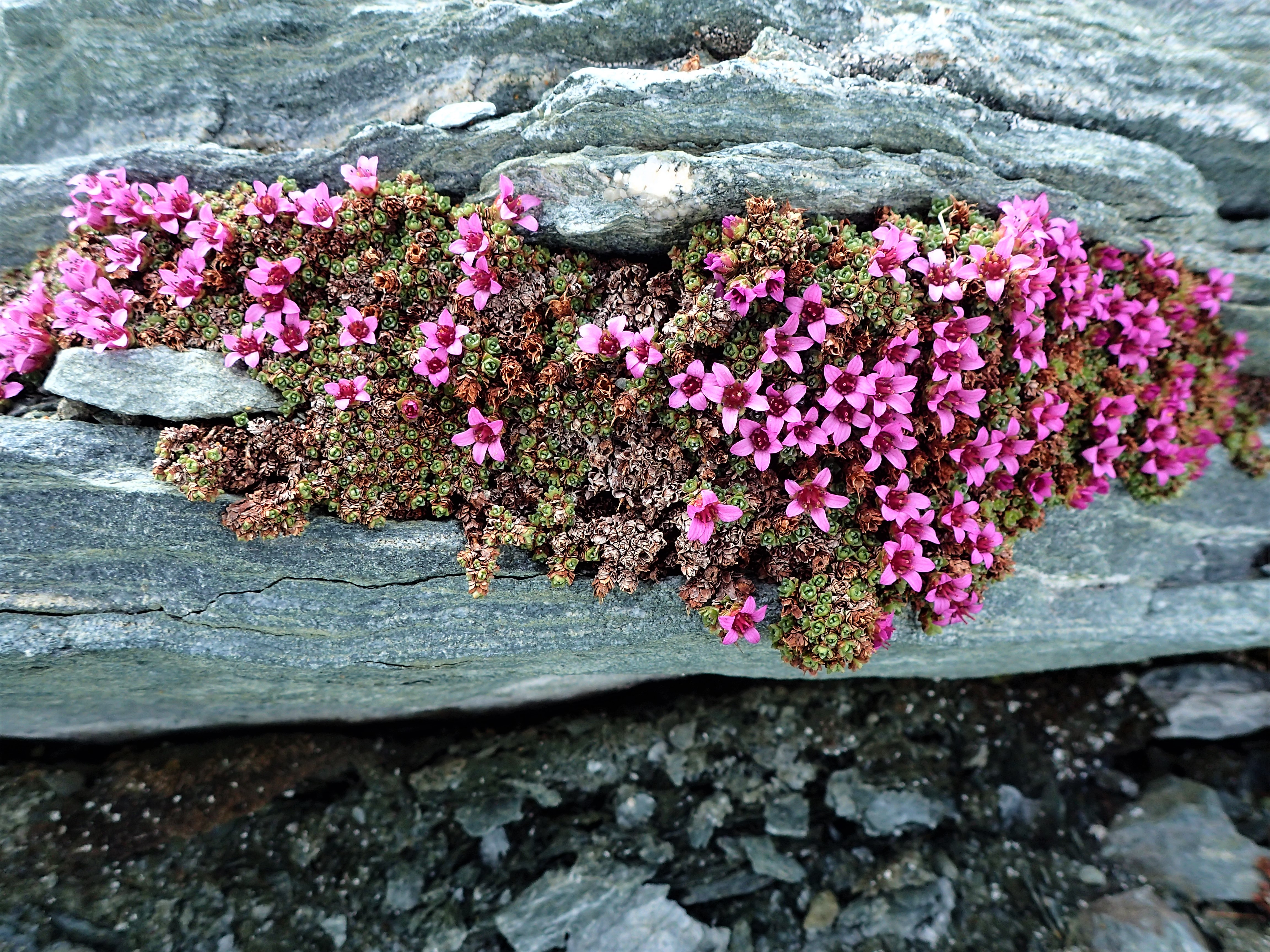
Stage 4. 6.00pm. Even though a grassy campsite beckoned nearby I felt fit and strong. I had recently put in some long days in the hills and also something about being alone was energising. Overcoming each obstacle, being totally self reliant. In remote country. I pushed onwards, upwards, first over deep tussocks then over scree stonefields without vegetation. The creek disappeared beneath the rocks. Safe and low angle. Just a trudge. Up. I got into a count, 1 to 20, 5 times over, then look up, check the progress, count again, and again. Slow progress. By 7.00pm I had reached a point where the creek reappeared below a series of waterfalls. My phone navigation app indicated I was at 1388m – I couldn’t believe I was still at least 300m lower than the lake. Stage 5. At least the way ahead was clear and the end point for the day in sight. A zig zag line up beside the main fall led through cliffs onto a shoulder. Moss and alpine flowers. The sound of falling water. Colder. Step by step. Look up, pick an objective 20 to 30 meters away, a distinctive rock mostly, reach it, pick another one, like a marathon run towards the end, just one small section at a time, step up, and again, and again. Eventually I made a col from where the lake opened out just beyond – green, beautiful, perched high on the mountain, a reminder of a glacier. A cutting cold wind. Always the weather, glanced out to the west to track changes to the cloud patterns, monitored the higher peaks in the distance to gauge the level of their cloud shrouds, stayed in touch, not a place to get caught unawares. 8.00pm. 10 hours, 15 km, 1400m ascent. Felt good.The days are long in NZ, the evening sun goes down after 9.00pm and there is light for a while after that. Tent up in the wind on a flat spot that had been cleared by other climbers and walled a little with stones. I anchored the tent by threading walking poles and tent pegs through the peg loops and then piling heavy rocks on top of them. Built up the walls a bit more to deflect some of the wind. Wisps of cloud played among the spires of Franklin’s upper ramparts. Jumped inside and cooked up. Warm food and drink, sheltered from the wind, jacketed, beanied and sleeping bagged. I felt cosy and cocooned. As long as the tent held up. The forecast was for ok, not brilliant, weather. No storms predicted. Things can change though.

Overnight the wind must have abated. I had journeyed deep into slumberland.

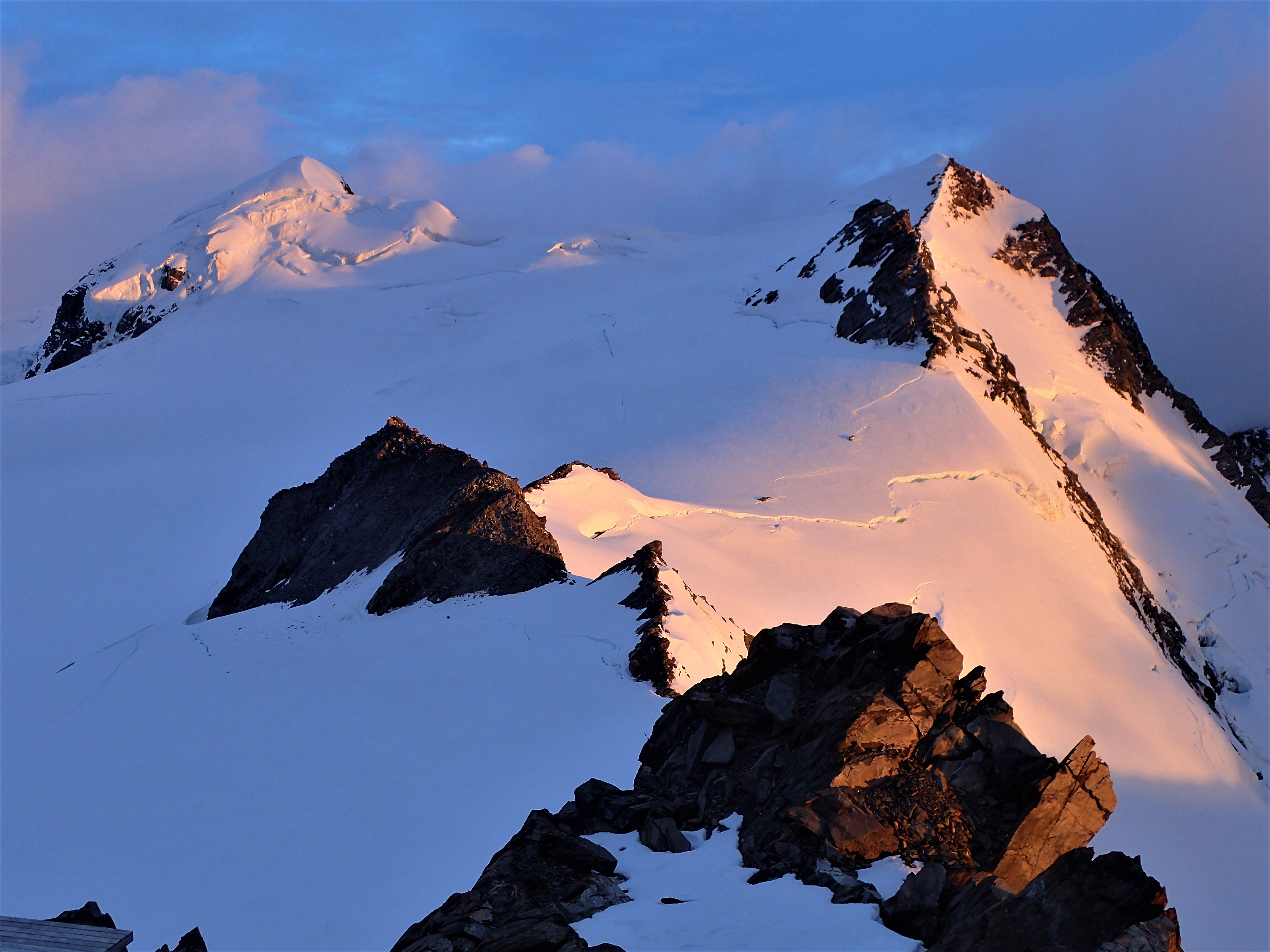
Dark cloud layered the western sky above the ocean. Mt Murchison, heavily glaciered, stood above the pack in the south west. Overhead was mostly clear. 7.30am. Packed up camp, hid all my stuff under a small overhang and covered it with rocks so the cunning keas couldn’t tear it to bits. I sidled around the lake on scree then ascended another stonefield to a high col on the narrow ridge separating Franklin from the peak above my camp.

Looking east from the col

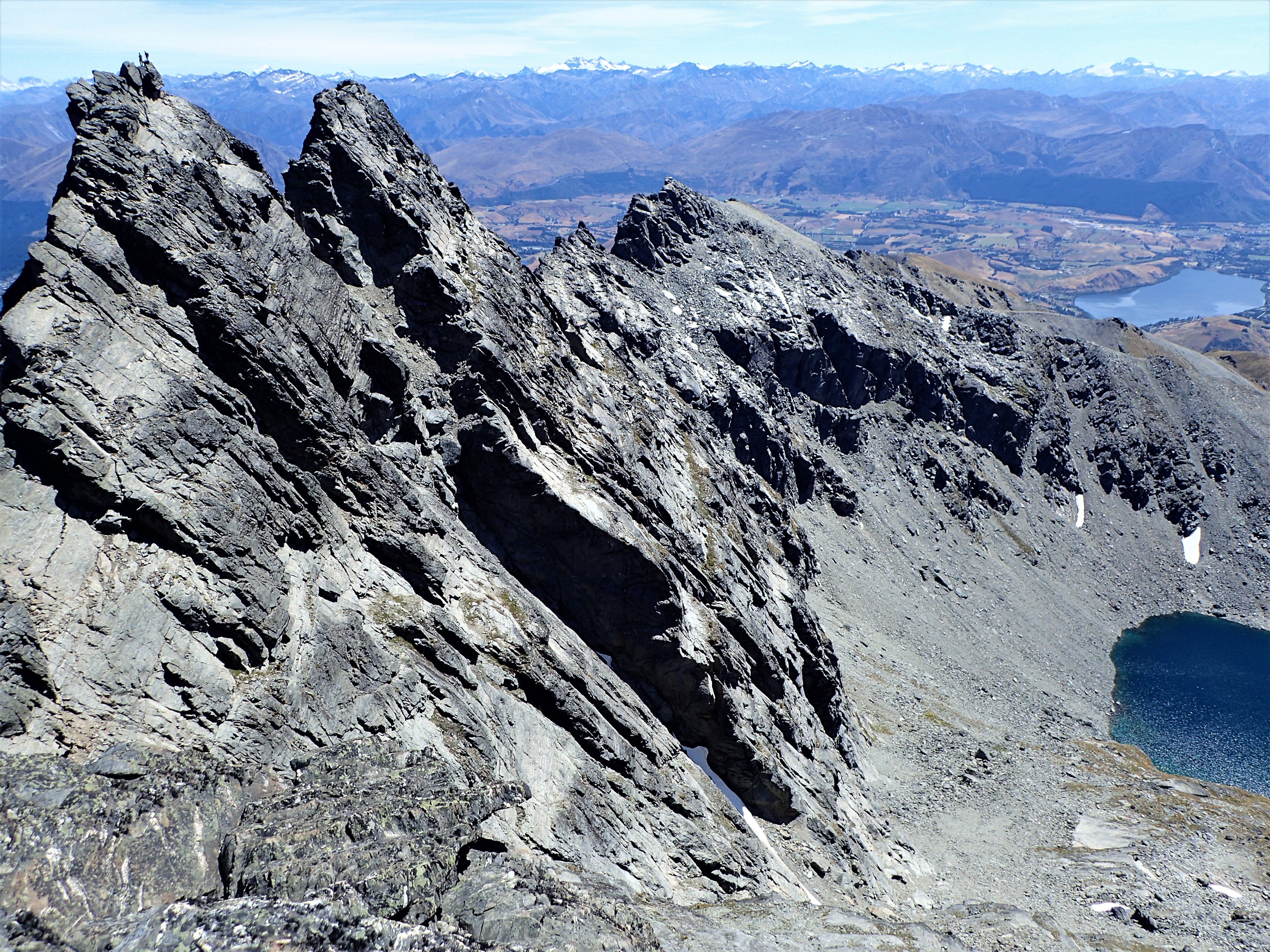
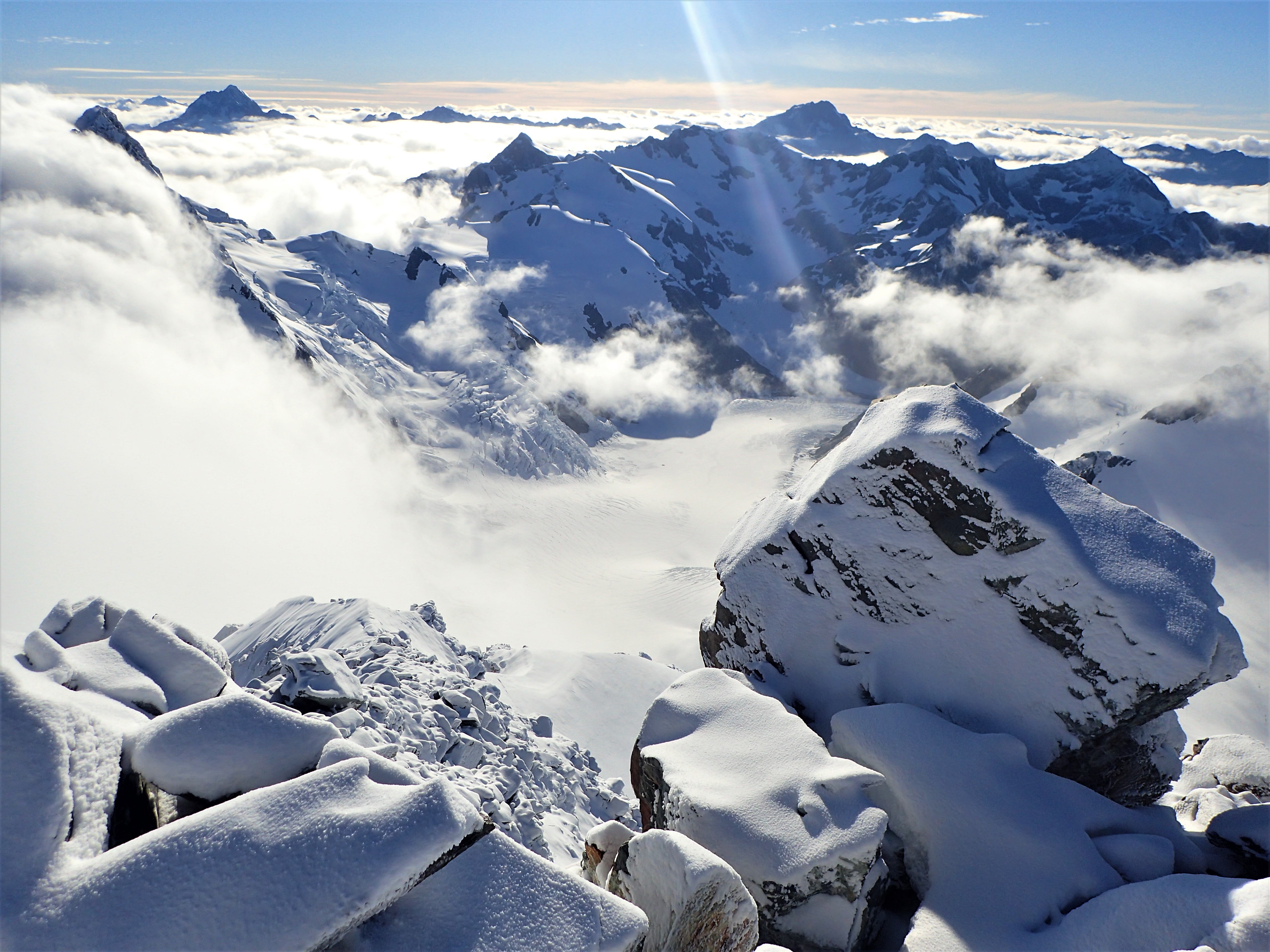
The view down the other side was magnificent, a huge drop to a hanging snowfield. A braided river silvered in the morning light up into a range of lower mountains. In a scene of quiet, slow drama valley cloud spilled over passes between mountains. Stage 6. In places the narrow spine across the col was knifedged. I scrambled carefully along, up and down, ledges one side, over a pinnacle, across a slab, down, along a line of footholds. A gaping abyss on both sides. Switched on. A few loose rocks kicked off. Crampon scratches from winter ascents. To the last col before actual Mt Franklin. Weather was holding, a breeze from the west wasn’t bringing the gloom any closer, Murchison had a cloudy head by then but it wasn’t getting lower or spreading to other peaks.“From the col above Lake Anna climb via the steep South Face and South Ridge (an excellent route)”. Close up it looked doable without a rope and gear and a buddy. Not as steep. A line of scree, always a line of scree, appeared to lead up to a traverse line right to a sharp ridge that spired up to the first summit. Stage 7. Each stage flowing into the next, like an adventure puzzle, piece by piece. I climbed, at last felt like I was climbing, route finding, moving up. Through the loose stones that fell away below over a drop. Out along the traverse line and then to the ridge. Up carefully. Gently move up on rattly holds. New Zealand weetbix rock. Up the arête. Move after move on black and grey. Always downclimbable if things got too deep, too out there. I wondered what it would be like in winter, in snow and ice, maybe more solid, glued and frozen together. First summit. Along to the next, and the next false summit. Finally to the last, but no there was another away over further yet. And eventually the cairn on the true top. Mountains and valleys in every direction.

Looking east from the summit

Nothing higher. Plummeting depths all around. I could see my campsite beside the jewel green lake way below. Rested a little. Kept glancing at the clouds and monitoring the wind. Ate and drank. Photos. A great sense of achievement. Thrilled I had pushed through each stage on the way up, into the unknown. With other people we would have done the same, most probably without using a rope, made the same decisions. On my own I had been singularly focused. Flowing through at my own pace was liberating.

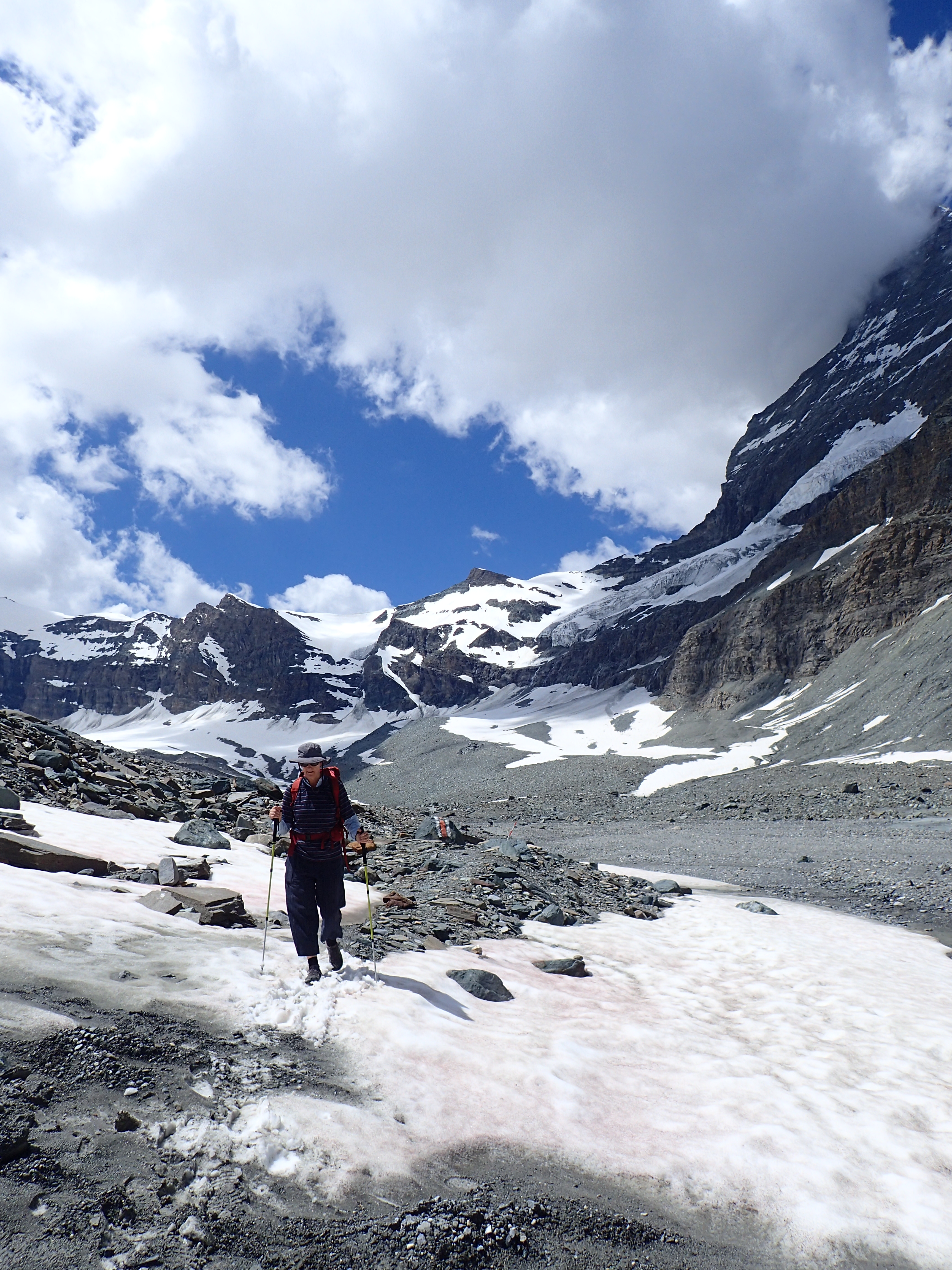
Down. I was keen to get down. Through the now known territory. Before the weather changed. Down the climbing sections switched on. And relaxed and so easy down the screes, slid down with gravity. 10.00am second breakfast in camp. Packed up. Retraced my steps. Spent time photographing the flowers and plants beside the waterfall. Endless stonefields.


A small deer in the tussocks. Across the scrubby shelf I happened upon more of the old track.


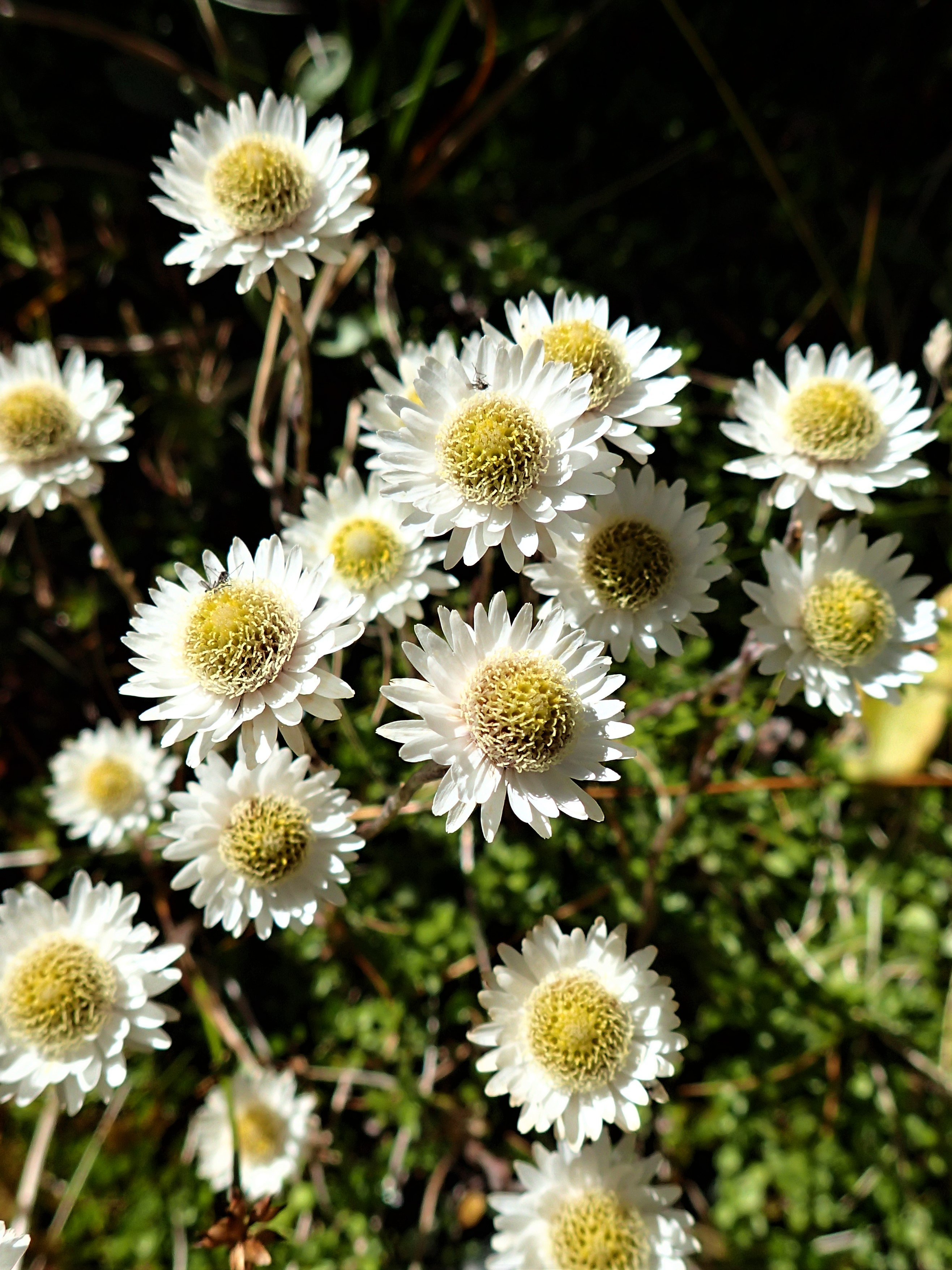
Found more cairns to follow, some that I’d added a stone or two to make them memorable for the return journey.


Lowered myself down the tussock gully back onto the “slide”. Like a grey river ready to carry me away. I sought out the gravelly runs and slipskied down mostly in control. Walking poles became ski poles. Then the larger stones that didn’t move were more laborious, slower. A fraction of the time. 2.00pm at the base.

Lunch. A plan was hatching – to get back to Arthur’s Pass at a reasonable time. This would enable me to make the most of the following day’s good weather forecast to climb Mt Rolleston. So I pushed on back up Deception River. Passed marshals in high vis vests, yellow sign posts through the river, helicopters overhead, a team of officials and medics at Goat Pass Hut and timing stations – all being put in place for the famous Coast to Coast race the next day. Across NZ in one or two days. International multi sport event. 1000 participants run, cycle, kayak. $1000 each. My feet got hot. I worried about blisters. Tired trudging with a lightness of heart. Easy going downhill. New Zealand mountain hikes always take longer than expected. It’s difficult to internalise the scale.

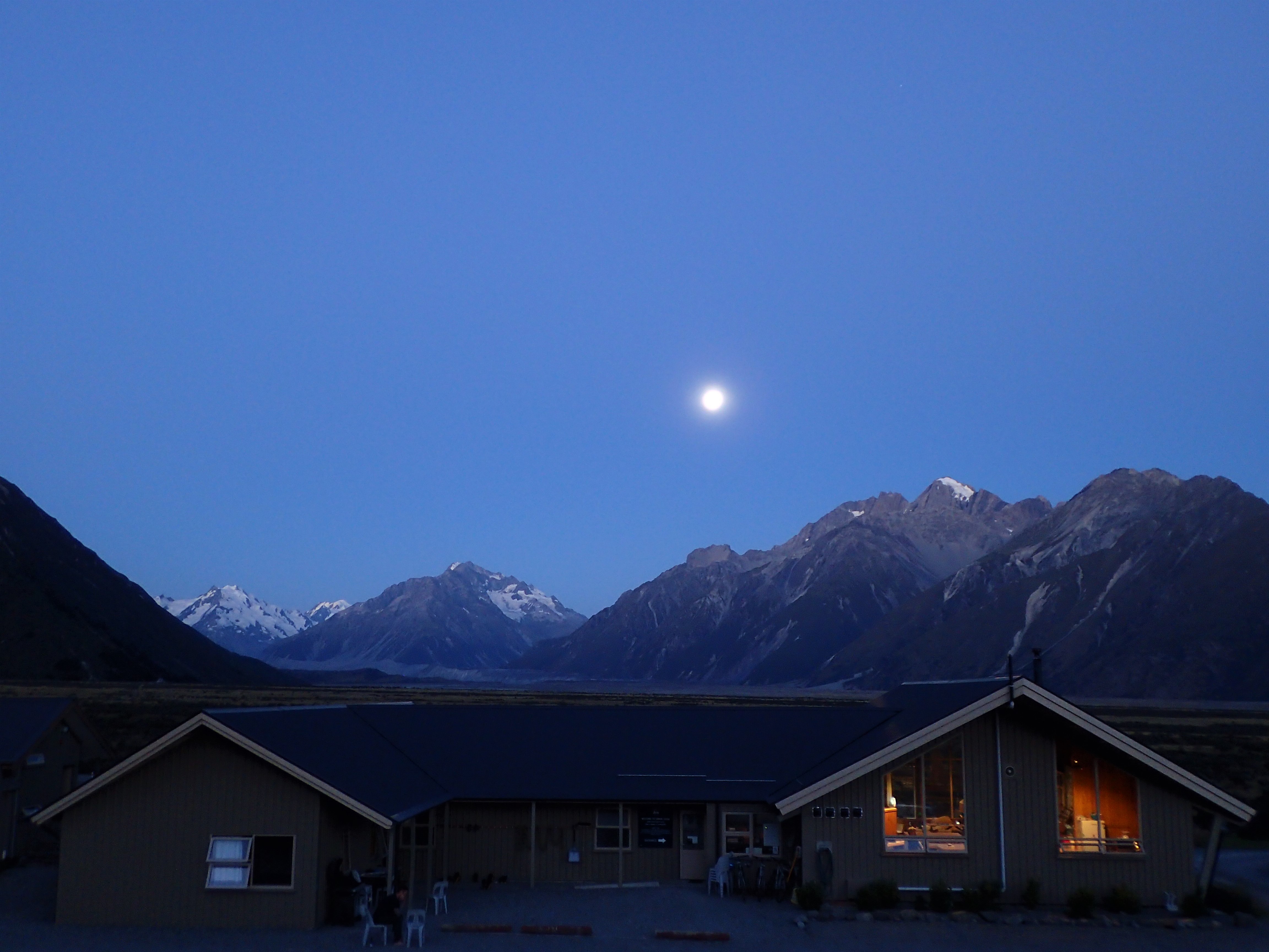
7.00pm. Back at the car. 11 1/2 hours. Camped at the DOC campground beside the road in the village. Packed ready for Rolleston. Bed. Slumped into stillness.

4.45am. The alarm went off. Without even opening the door of the tent to check the weather I turned it off. Wonderful, soft slumberland. My legs were heavy. Best horizontal. Rolleston would still be there.

Later that day. Over coffee the weather up high had clouded in. Visibility would have been almost zero. A lucky decision. Rest.

The 100 Peaks Challenge. I’d never heard of Mt Franklin. Not a must do mission. Not necessarily the best climbs or the tallest mountains. More a guide to encourage people into the mountains. Thank you NZAC for this centenary initiative. A structure for a lifetime of forays across The Ditch. Now my list has its own scratchings and additions.

Postscript – the following day I overnighted at the NZAC lodge with a noisy crowd of Coast to Coasters (slept in my tent on the quiet grass outside to escape the snoring and 4am comings and goings).

Zermatt Adventures – hiking, via ferratta and basic mountaineering

All the walks described here are very briefly outlined on the brochure map “Panorammakarte/Plan Panoramique/Panoramic Map” which is available in tourist information and accommodations for free in Zermatt. Also on the www.zermatt.ch website. Hiking routes are graded and times estimated. See also the Cicerone guide to “Walking in the Valais”.

Five Lakes Walk – 5 Seenweg

Hike

2 1/2 hours, mostly downhill. Start – 2 funicular lifts from Zermatt to Sunnegga then to  Blauherd. Finish – Sunnegga, funicular transport back to Zermatt.

An underground funicular railway took us from Zermatt to Sunnegga and then a cable car to Blauherd at 2571m. Immediately we were on a high mountain shelf with sweeping views of the valley far below, alpine meadows and the higher snow capped peaks. The Matterhorn in the distance towered above everything.

Sidling the hillside led to the Stellisee, crystal clear water, the snowy dome of Monte Rosa as the backdrop. Wild flowers, herb fields, the Matterhorn ever present. Classic, iconic Switzerland. Cath walked ahead, like “Heidi”, in high spirits. Sunshine. Views from postcards in every direction. It was hard to take it all in as the path wound down gently and occasionally more steeply in switchbacks. The Grindjisee was partly surrounded by stands of fir trees like scenes from a fairy tale. Down lower we crossed a stream torrent. Crimson flowered low heath, more small fir trees and boulders edged the Grunsee. Then it was steeply down a narrow trail beside another tumbling stream to the Moosjisee, a man made small lake of opaque aqua. Finally over a small rise to the Leisee. This lake, closest to the cableway, had a beach, seats for relaxing and was the swimming spot for hot days.

On a varied, gentle, spectacular 2 1/2 hour walk mostly downhill we had become fully immersed in the Swiss Alps.

Mettlehorn

Basic Mountaineering

This is a serious full day hike involving the use of crampons and ice axe to ascend the top snowy valley and final peak but without the danger of crevasses. 1800m of ascent and descent. “Superlative…for many years it was seen as one of the two classic training climbs of the region….” Kev Reynolds, Cicerone Guide to Walking in the Valais.

The trail to Trift departed from the village centre of Zermatt. Between hotels then old wooden cottages and into the forest the steep path zig zagged upwards. 300m higher the Edelweiss Alterhaupt perched on a promontory overlooking the whole valley and offered drinks and food. Onwards and upwards, hard snow covered the cascading stream in places. A deep gouge made a  furrow through a section of ice to the next section of trail which switch-backed through steep rock where thick ropes had been attached as handrails. The grassy slopes were laden with a hundred different types of windflowers – yellow, white, pink, purple, blue, red. At the edge of perception I could almost hear tinkling cowbells and yodelling. Another 400m up I reached Hotel du Trift set wonderously at the base of a huge cirque – the Zinalrothorn, Mettelhorn and Unter Gabelhorn towering above. The hotelier, breakfasting with guests at a table in the morning sun, offered advice on the weather.

The trail branched off into steep herb fields flanked by another tumbling stream. As the altitude increased the Matterhorn became visible above a ridge line. Over a rise I reached snow patches in a hanging valley where I threaded my way up on exposed grassy and rocky areas until there was only snow. It was soft enough underfoot to be secure without crampons and it steepened towards a high col. Here the view into the next valley opened out – a snow slope dropped down into a bowl where an exquisite small blue watered lake lay enclosed by ice, and below this the valley wall plunged way down to then rise up opposite to snow and ice covered peaks along the range to the north to the perfect, jagged summit pyramid of the Weisshorn. Cloud moved slowly through the landscape, alternately obscuring then revealing the surrounding mountains. Fairly confident I could retrace my steps if the mist came in and stayed, I put on crampons and swapped walking poles for my ice axe. The snow was still soft on the surface.

Occasional glimpses of the summit of the Mettelhorn beckoned me across the snow (neve) below the Platthorn and then further to a steeper snow slope that led up to the final rocky section. Feeling the altitude I moved in sections, each interspersed with short rests, zig zagging upwards. The  snow slope was edged by a massive drop into the valley.

At the top I rested, lunched, photoed. Took it all in. Hung my legs over the void. Watched the mists and cloud swirl and drift. Figured the mountains in the 360 degree panorama, made some plans for climbing futures. Felt glad to be alive, overwhelmed really, thankful to be healthy, on top of the world.


Then down. Concentrated. Took great care. Each step placed carefully, to catch a crampon spike or trip would have led to a slide, and hopefully a self arrest with the axe but much better not tempt fate with a fall. Cramponed feet kept apart. Down past the col as the incline lessened I could relax and slide a little with each lengthened stride and make good pace. Back at Trift I couldn’t resist a hot chocolate. Just out of the oven an apfelkucken appeared as if by magic, with cream. Nearby a Swiss flag fluttered above a garden of flowers and in front of a gushing waterfall in the middle distance, while above glaciers caught the afternoon light. Down through the fields of flowers. Everywhere tumbling water sounded through the stillness in tune with my own sense of gratitude and vitality.

Matterhorn Glacier Trail

Hike

A half day hike traversing the lower shoulder of the mountain. Gently undulating from Trocker Steg (2 cable car rides from Zermatt) then down to Schwarzsee (cable car descent back to Zermatt). Like being in the “throne room of the mountain gods” Galen Rowell.

The cable cars swept us straight out of the valley to the snowy shoulder at the true base of the mountains. We wove the path between stoney rises and glacial lakes. On one side was the icy ridge of the Furgsattel that led up to one side of the Matterhorn, Italy lay just beyond. In front the lower glaciers gave way to sheer rock walls that led up into the clouded summit of the famous mountain. My eye was continually drawn to the Hornli Ridge that faces directly towards Zermatt. This is the popular and historic climbing route that one day I might hope to climb unassisted by guides. We walked slowly from vantage points to lakes and then to stop to just drink in the scene. Stupendous. Monte Rosa, brilliant white, behind, the rounded dome of the Breithorn almost directly above, and the sharp peaks that lead to the Weisshorn. It is hard to imagine a more sublime mountain scene. The cliched shape of the mountain seemed to retain some of its mystery and power by being partially shrouded in mist for much of the time. Following the season of enormous snowfall and probably due to some extent by global warming the whole scene was alive with flowing meltwater. The Hornlihutte stood on a level section of the ridge above, enticing.

This must surely rank as one of the finest short walks in the world.


Via Ferratta/Klettersteig Zermatt

Via Ferratta

3 seperate but linked “iron ladder” via ferratta routes have recently been established on the crags above the village on the west side. The access trail leads up from behind the railway station or off the path to Trift, signposted. 15 minutes hike uphill from Zermatt to the start of Route A or B.

Route A – good intro to techniques and to a little exposure

Route B – intermediate to advanced, steep, exposed, some strenuousity

Route C – continues on from Route B to a high grassy slope


Linking all three routes takes about 3 hours plus another hour for the descent via a hiking trail (if you know what you are doing). An info brochure is available from either the Tourist Info office near the railway station or the Zermatters Alpine Centre. There is no cost for the activity if you have experience and equipment (helmet, harness, via feratta set – these can be hired in the village). Guides can be paid to take you through the course and provide instruction – see the Alpine Centre.

The real climbing started beneath the main cliff face with a steep ladder up blank rock. This was followed by a series of traverses on half logs, natural foot holds and iron bars and rings. These were linked by ladders in a mix of natural climbing and use of the ironwork, all protected by newly laid cable. At a particularly exciting part you are high on this cliff way above the village in quite hostile terrain below a large overhanging roof system with another overhang below. Spectators from the village can watch people climbing across the black, grey and yellow rock. At the top of this section you hike along a vegetated shelf to a larger cliff which is ascended on a series of ladders and natural foot and handholds. The cable is always at hand to affix the via Ferratta carabiner cords and also to use as an aid to climbing. As you ascend the views just keep getting better. After another linking short walk I met up with a pair of “amigos” from Barcelona. For the third and final large cliff of steep and spectacular climbing we photographed and videoed each other, chatted about climbing in Spain, Chamonix and Australia and had fun in each other’s company.

Breithorn Solo

Basic Mountaineering

This is the easiest of the 4,000m peaks in The Alps (4164m). Half a day. Start from the top of the Matterhorn Glacier Express lift from Zermatt. Equipment required – ice axe, crampons and walking pole. People who are not comfortable with use of crampons and ice axe and not experienced with glacier travel should hire a guide from Zermatt.

My concern going solo was crossing the glacier which could contain hidden crevasses. Without a climbing partner on the other end of a rope there would be no chance of stopping a fall through the snow into the hidden chasms in the ice. After much research on the possible dangers and risks I decided to go up and have a look and assess conditions as I found them on the day. In beautiful weather I walked along the ski run following a pair of other climbers and not far behind a guided group. A route across the glacier was well compacted by the feet of many others. I could not see any sign of crevasses so followed this pathway over the snow. Other groups roped up and put crampons on and some just hiked across like me. On the other side where the slope from the summit dome of the mountain steepened I put crampons on and got out the ice axe. Most people were now roped together however some others walked up unroped and skiers ascended also unroped but with ski crampons on.

On the day it seemed safe to make the crossing. Also I presumed that the guides take on full responsibility for their clients by having them roped in. There was also the possibility that they try to maintain an atmosphere of peak adventure and an air of being necessary for the climb. Previous reading had indicated that they did get fed up rescuing people who were not properly skilled or equipped or prepared – fair enough. The angle and runout closer to the top was such that an uncontrolled slip from someone unroped or unable to self arrest with an ice axe would have resulted in an accelerating slide off the mountain.

The summit is truly spectacular. There is space to sit safely for lunch or stand and appreciate the magnificent view of peaks all around and the valleys plunging way below. There were certainly a number of other people to share the experience with but being climbers and skiers, all with an interest in the challenge and aesthetics it didn’t detract from my enjoyment. The altitude affected people in different ways – there were some really struggling to keep up a slow pace and others who were probably better acclimatised. From the top the safest and easiest way to descend is to follow the same route down. Down the narrow furrow of footsteps in the snow back to the glacier.

An exciting alternative for the confident and sure footed is to continue along and then down then  narrow snow ridge to the east. On the northern side of this ridge is an almost vertical drop of thousands of feet to the rocky talus below and on the southern side it is slightly less so. Passing the occasional person necessitated one person to leave the narrow foot pad and stamp out some foot placements in the snow on the steep slope just off the ridge crest. The feeling of moving through the mountains was intense – grand scenery, concentration, brilliant aesthetics, physical exertion and mastery. From a saddle further on it is possible to ascend to the next summit on the ridge which consists of a narrow cornice. To climb further and keep following the ridge would be fabulous real climbing over steep mixed rock and snow in a classic alpine position, probably requiring a buddy and a rope. Next time I’d have both and aim to do much more – the Matterhorn, Monta Rosa and maybe even the Weisshorn and Finsteraahorn. The list grows but also becomes clearer with each step into this landscape.

Back down to the saddle it is then a straightforward trek back down to the main trail. A single narrow but deep crevasse, easily crossed, kept me focused. The snow had softened by early afternoon making the walk back a little tiring, though it was all downhill or flat.

Gonnergrat to Riffelalp via the Mark Twain trail

 Hike

The third in our series of “this must be one of the best short, easy hikes in the world”. 2 1/2 hours though more time is recommended to fully immerse in it. Start at Gornergrat, having most likely caught the train up from Zermatt to 3089m.

The main trail downhill leaves the stupendous view from the lookout platform. With the crowds of tourists seeking a pleasant walk through the iconic Swiss mountains you wander down a network of trails towards Riffelsee. The wonderful mountainscape of the Breithorn, Castor, Pollux, Liskamm and Monte Rosa rises up above the Gornergletscher glacier below. Huge hanging lumps of ice cling to the mountain tops ready to crash down. Rapidly melting rock strewn glaciers feed raging torrents. Silently standing aloof the Matterhorn beckons the walker onwards and steadily down. Wild flowers become more prolific as the altitude drops. A thousand photo opportunities present   themselves with the mountain as the backdrop. Even I, who wholeheartedly loves the mountains and the natural world, was surprised at how much pleasure everyone was gaining from its presence. Beautiful alpine lakes bubble into an alpine stream past the rocky bulk of the Riffelhorn. Most of the tourists depart the outer trails here heading for the Rotenboden or Riffelberg stations.

The Riffelseeweg trail leads into the Mark Twain Weg which is an absolute cracker of a walk. At first the route winds down following the stream between rocky bluffs and flowered herb fields. Around every corner was a new scene just made for a toblerone advertisement. It was hard to move past the notion that we were walking in some fairy tale or through the “Sound of Music” or that we might have been “Heidi’s” grandparents in another time and place. This was actually real. Across the face of the hill the track is dug into the steep slope and this is where the flowers intensified into fields of yellow and white that covered the grasses which dropped away into the Gletschergarten gorge. Crimson alpine rose undergrowthed small fir trees on the steep rocky sections that led us down to Rifflealp.

Remarkables – Grand Traverse – Summer Solo

High above Queenstown and Lake Wakatipu the skyline is jagged with rocky spires. From almost the lake’s edge the ground rears up skywards through a wild country of grassed ridges and walls. All of this catches the wind, the storms, the snow and the late afternoon light. So close to civilisation but not to be underestimated.

A friend and I did a climb on the North East Buttress of Single Cone, one of the three pinnacles on the Traverse. The rock was coloured grey green and veined white. Smooth slabs had off sloping holds and overlaps. After two pitches we reached the less steep upper section where we could unrope and scramble. Up gullies, featured walls, slabs and finally the main ridge which ran through to the top. This climb was a familiarisation of the access, the climbing and also primarily a chance to scope out the descent at the end of the Traverse. All checked for the next day I scrambled down to the walk down track.

We all walk our own line of risk within a complex interplay of skill, experience, confidence, motivation. On my traverse day I would be going solo.

Remarkables at the head of the lake – early morning

I drove up the winding mountain road with my favourite tunes cranking through the spectacular landscape. An hour’s hike up from the ski field base and past Lake Alta arrived me at the Traverse proper, below a set of cliffs that topped the main ridge and provided a high point for a communications tower. At this level I headed across a large undulating shelf. I undulated down at one stage instead of regaining the ridge which meant that I had to scramble through some tricky terrain before I could climb up to a helipad. This switched me on, focussed my mindfulness about each move, made me start to feel “out there” a little, exposed. I’ve done a few solo things, including some long climbs at Arapiles. My mind tangled with the contrast to having a buddy around. A list of about a hundred mountains to climb in New Zealand and only probably 20 more years (61 now) to do as many of them as I can carries part of my motivation. Plenty of rockclimbing and hiking are under the belt but I only started serious mountain climbing two years ago with a sudden set of circumstances that enabled me to have the time and the means to stretch into real mountains. An unexpected dream coming. In my backpack I carried a harness, short rope and a small rack of gear for any difficult and scarey descents. Or to retreat.

“To be clear, I normally climb with a rope and partner. Free-soloing makes up only a small percentage of my total climbing. But when I do solo, I manage the risk through careful preparation. I don’t solo unless I’m sure I can do it.” Alex Honnold.

The day before there had been about ten parties on the Traverse whereas on my climb day I could only spy out one other. They were up ahead, roping up the ridge towards the North Peak of Double Cone. There was an easier route up a series of ramps on the left side of the ridge which I scoped out as the most straightforward way ahead (this is the route in the guidebook photo topo). Once I started though the actual ridge became my route of choice – the rock was mostly sound and the actual climbing moves were fabulous. Not hard but interesting. Huge drops down either side of the knife edge. Queenstown way below, snowy, iced mountains to the west including Tutoko and Earnslaw which remained on my list, and Aspiring. Way to the north Cook’s distinctive shape was visible on the horizon – beckoning. Narrow flat sections required confident balance, in places I crouched and ran a hand along the edge. When the holds ran out on one side of the ridge there was often an alternative on the other. A steepening towards the top drew me away from the edge then to the summit. The views all around were sensational.

It took a little time to find a way down the steep section to the gap between the North and South Peaks. The guidebook recommends considering rappelling if the sloping ledges are covered in verglass (frozen water ice). Fine in good hiking boots and dry summer rock. In many places the rock was scratched from crampons. The prospect of a winter climb, with a buddy and a rope, was enticing but a completely different sort of challenge. The group in front pitched their way up slabs from the gap, the top of the Petit Couloir, and an exposed arête. I found solid holds for hands and feet and continued up to the south summit of Double Cone. Rock shoes lay unused in my backpack. I first lunched on top while the other group did the same on the next pinnacle. Across the void we nodded at each other and exclaimed the beauty of the day. I loved being on my own, felt I was in my element, wide awake to the world, confident moving over the warm rock, in striking terrain.

Between the South Peak and the next gap, the Grand Couloir, was uncomplicated. I left the others, who were pitch climbing up the edge of the ridge, and this time followed the photo topo from the guidebook up a series of linked slabs and to the top of Single Cone. These slabs were riddled and crisscrossed with extrusions of white quartz, in beautiful profusions of patterns and wriggles, that appeared like writings, hieroglyphics, telling the stories of the mountains for those that could decipher the language of the rocks. I could only ponder the geology and appreciate the aesthetics of the figures. Run my fingers over the intricacies. Second lunch on the summit. Two other later climbers topped out on the South Peak of Double Cone. Their silhouettes against the deep blue above the horizon of the Main Divide looked stupendous. In my exuberance I felt like shouting over to them to ask their email addresses so I could send them a couple of cracking photos.

On the familiar ground of the ridge from the day before I descended. Not quite so keyed up from the unknown. The South East Gully must have been a little further along the summit ridge – I would probably need to rappel this if I climbed the traverse in winter. Back down to Lake Alta, hardy people swam in the glacial green iced water, tourists hiked up in the afternoon for sunset photos.

Notes

Scoping out the access the day before was very beneficial.

Conditions can be changeable – wind, rain, snow etc – can change the nature of the Traverse significantly.

As an Australian rockclimbing instructor I would always recommend having a rope, a buddy to hold the rope and gear for pitching.

The info and photo topos in the “Queenstown Rock, Ice and Boulders” is excellent and highly recommended. $50 for a “Grand” adventure.  From NZAC or outdoor gear shops in NZ.

Tasman Distress

Tasman Distress

This article was published in the New Zealand Alpine Journal 2018

Hiking up the lower Tasman

Our mountain is hidden behind closer, lower peaks of the range. On the left is the Tasman Glacier, the great hulk of Mount Wakefield, then further left in the view is the Hooker Valley and the Peaks of Footstool and Sefton and high hanging glaciers. Through the large picture window of the NZAC’s homely Unwin Lodge to the right is another rage of giant hills. Hidden as well is Mt Cook, whose presence is felt everywhere.

 Malte Brun. Copious research. Maps. Training runs. Guidebook. Internet. Training hikes up hills with a weighted backpack. YouTube videos, blog sites. Lightweight gear purchases piled up at home. Aesthetic and solid red rock perched high on top of the range across the valley from Cook. An expedition certainly. From the ground up. Just hard yakka that might lead us to the prized summit. Charlie and I were to go lightweight.

 A weather window of 5 reasonable days. First steps on the dirt road to Ball shelter the pack felt heavy. I adjusted the waist strap and the chest strap and the shoulder straps for the first of a hundred times. Boots felt clunky and heavy and hot. Not certain whether the car was locked Charlie walked back to check. Everything was hot. Blue sky. Hard work. Rest. Drink. Sunscreen. Trudge. I questioned whether we needed all the stuff loaded up. Charlie’s pack looked too big. Mine just felt heavy. Hot. We took a wrong track into steep moraine then backtracked and struggled steeply uphill to a higher level. Tripped over and landed a bruised cheek. 3 hours to the shelter, 9 km. Water, shade, lunch. The first beginnings of blisters. Should we have called it early and bailed out? Together we decided to push on.

 We needed to descend 100 m down the steep moraine wall. Looking out it was entirely evident that we had embarked on a big adventure, a Big Adventure! Everywhere were off vertical cliffs of dirt and stones. This is an active geological country and erosively alive. Global warming had awakened a monster. Along the length of the wall everything was falling down. Glacial retreat has been up valley and the level of ice had gone down vertically as well. Tall cones of loose stones, dirt and boulders towered in triangles up from the base, at the ready to slide or accept a top up from above. The top edge was scalloped with collapsed sections that appeared as bites out of the earth. Our first challenge was to locate the safest recommended route down to the floor of the glacier.

 Careful perusal of the copied out text from the new guidebook kept at the Lodge. We located the recommended bite and rocky line down. Steep. Loose stones. Gravel slid ahead. Step on the rocks that seemed to be more firmly bedded into the dirt. Down. Steep. Don’t slide out. Zig zag a little. Link up through a bouldery, more stable section. To an intermediate shelf then along a remaining morsel of the old foot trail that was yet to tumble into the gulf below. On this level we gazed out with growing dread at the 5 km of rocky moraine floor that stretched seemingly forever before meeting the white ice way off up valley. It was a moonscape out there, hilled and valleyed. It conjured a scene from the approach to Mordor at the ends of the living earth guarding the fires of Mt Doom. We spied out a route through the first part with a series of go-to points – a dirty white ice cliff, a heart shaped rock then a large shadowed boulder. Down the second section. More dirt and less rocks here. Finally safely to the base.

The first steps would be just like the last across the fierce moraine. Boulders and rocks of all sizes lay in a mess of small hills and valleys interspersed with occasional steep, slippery stone covered ice slopes. Gruelling work. Many of the rocks wobbled or tipped when weighted. Our walking poles skittered and held weight in varied, random degrees. Hot. Sweat. We sat together in the vile, lifeless wilderness on the odd hot flat perch. Drink. Battle through another section. Pick an objective 50 m away and work slowly towards it. Don’t focus on the whole mountain just break it down into small achievable sections. Grinding heat. Still. Progress was very slow. Painfully slow. Literally. For hours under a baking sun. A heat wave. Dry. Parched. Hot rocks above the ice hidden far below the surface. We rationed our water. Precious sips. Sweaty sunscreen. Across the ferocious desert. After several hours of torture every ridge beckoned ahead to be the last only to disappoint like another false summit. Thinking of Frodo struggling with the weight of Middle Earth on his ring into Mordor we pushed on with packs way too heavy. Hot. Dry. Almost out of water we stopped above a large depression. The loads on our backs removed, ice slopes led us down to flowing water. Blessed relief for our thirst, iced water, relief from the heat under an overhang of hard blue ice and, most wonderfully, a large cave of ice caverned and tunnelled away, carved in sinuous flowing runnels of deep blue cold ice, which could have been inside the glacier for millenia. Like veins in the living ice. Now melting before our eyes. We were seeing into its heart, into its within, face to face with the meeting of heat and ice – it shouldn’t have been like this. Out of the brief respite we trudged on with aching feet. A small mountain of rocks promised a finish in the distance only to again deceive. Hot. Finally a narrow ridge provided a key line between crevasses in the transition zone between the bare rock plain and the retreating white ice of the glacier. 5 1/2 hours of torrid torture. This is what it had come to now. Apparently only decades ago the same journey could have been done in quick time across wide tongues of exposed ice through the rocks – relatively easy hiking. A steady stream of helicopters now carried tourists and other climbers unwilling to undergo the effort of the crossing. It is no subtle irony that the same helicopters contribute to the climate problem. We had elected to pay our dues and learn the terrain as it is now.

At last the ice highway

Walking on the smooth ice was highway like. At times we wove a path along raised lines between furrows and hollows. Small streams of melt water drained the surface and joined to form larger flows that disappeared into holes small and large. Some were filled with water and others were rushing waterfalls. We could feel it melting around us. Intense bright light. Everywhere a drink. A little further for the day.

A flat spot in amongst some boulders on the ice in the middle of the glacier made for an “expedition” style camp. A tent area was levelled with ice axes, a big table rock the kitchen bench. Right beside the tent was a small moulin which was round and a perfect size for billy dipping to collect water. Like a narrow mine shaft it disappeared into the mysterious depths of the ice. Mount Cook and the Minarets towered above. Small avalanches from perched glaciers way above broke the stillness with waterfalls a constant background. Cool katabatic breezes and strange wafts of warm air alternated from up valley. The light slowly dimmed and the full moon rose. We cooked and ate then lay down in warm bliss cocooned in down. In the darkest hours of the night doubts drifted through a period of half sleep – we were cut off by the desperate moraine from a straightforward escape, was it all too hard, were we carrying too heavy loads, would our (mine anyway) oldening body cope, had we bitten off more than we could chew, should we call it in the morning before we got ourselves even deeper in???? Some moisture seeped through the tent floor in the night and wetted part of Charlie’s sleeping bag.

Early morning clear. The weather conditions were even better than predicted from my hundred pre-trip checks. We had a window of maybe 3 1/2 more good days. All being equal this should be enough. It was why we had reorganised the trip so we could be just where we were. Muesli, tea. Charlie seemed keen to go.

Up the ice. Smooth and hard and slippery from overnight cool. Crampons. Along the floor of the valley our way was shaded and cool until the sun crested the mountains to the east. A valley opened way above the moraine wall which revealed our objective silhouetted in early morning light, still 2000m above. We made a good pace, slowed only at a bend or where the angle increased causing the ice flow to shear and crack into crevasses and compress into hillocks. Zig zag. More surface streams and creeks flowed into holes in the ice almost beckoning us to slip and slide in. The whole range felt alive with erosion and flow and occasional falls of rock and ice. Sound, movement of the breeze. Tasman seemed to have a living presence, cold and hard and aloof, strong but fragile, watching, sensing our passing maybe. Holding us to account.

Helicopters started early ferrying the tourists up from the village to walk and explore the ice, and climbers, unwilling to effort themselves, to huts and mountains that in times past had only been accessed on foot up this massive river of ice and rock. Below the Beetham valley a stream rushed steeply downslope besided by more steep moraine walls of dirt and stones. In those past times a safe route up the more stable slopes had enabled access to a high hut which was used as a base to climb the mountain or access another hut near the now disappearing Malte Brun Glacier. Now further up past the outlet stream of the Malte Brun and Turnbull Glaciers was our recommended route. From out on the ice all the possible options looked desperate, the sort of things I sometimes had nightmares about – cliffs of dirt and stone that would crumble down faster than you could climb up. Perception was foreshortened and when we actually made our way to beneath the most likely looking bouldery stream line disappearing skywards its angle was slightly less than the critical steepness between definitely unclimbable and possible. Sometimes it’s hard to judge something until you actually step onto it and engage with the parameters. Our key line up consisted of larger rocks piled together between the finer and smaller steeper walls. The rocks were mostly settled on each other in reasonable solidity enabling upward progress. Occasionally one would dislodge and tumble down a few meters to come to rest again. Many had to be gingerly weighted. Helmets on. It felt good to be scrambling, without poles in hand. The responsibility of the person higher up was to be extremely careful not to send rocks that could take out the person below, and that of the person below was to try to climb to the side of the fall line of stones from above, and to trust. In an unspoken pact of connection with one another we slowly ascended. At the first steepening the boulder line changed to dirt and loose stones. We angled across and up to another line of larger rocks. 100m. Slow. False lines led into other steepenings. 200m. Rest. Apart. Easier more secure sections then others less so. Hot. Hard work. Exhausting. Another drink. Rest again. A false top. Eventually a saddle came into view over to the right. It took an age to reach. 300m.

A little higher again we crested a ridge into the most sublime scene. A snow covered remnant of the lower Turnbull Glacier nestled under an unnamed peak of vertical red rock. A large section of ice had broken from this and floated in a small magically blue lake. The higher glacier fed a stream that rushed and tumbled noisily over large blocks of stone into the lake. Another stream flowed out of the lake and down onto lower slopes. On the higher white slopes of snow a party of two tiny climbers inched slowly upwards, 3 hours ahead of us. Other red peaks towered around the cirque and the buttresses of the summit block of Malte stood above these.

We pressed onwards in the mid-afternoon towards the upper glacier. A little higher we sat exhausted, filling water bottles. We still had two separate glacier sections, a rock step and 600m more of elevation between us and our intended bivvy spot. We weren’t going to make it in time. We had either been too slow or hadn’t allocated enough time for the approach. Our anticipated weather window didn’t have any leeway in it to allow for contingencies like this. Take any more time and we would expose ourselves to a possible huge lashing storm in a tent for several days. We had both experienced such storms in the huts nearby and vowed never to be caught out in the 100+mph winds and seeming oceans of rain and snow that fall from the sky. Together in a matter of a few minutes we called it in, made the decision and decided not to push on. Rested for a little. The year of planning and prep and training would come to nought. The dreamed of summit would not be ours to savour. Elusive. Disappointment.

Down. Descent back beside the narrow torrent to the lake shore. A single flat tent site right beside the lake. Packs off. Sat. Rested. Ate. Drank. Removed the big boots that encased tired, aching feet and a couple of blisters. Hot late afternoon sun. Snooze. Put the stove on for a brew. The tent up. Like a man cleansing his soul Charlie immersed himself completely in the ice water three times. I walked around the lake shore to the snow slope. The ice flow was close to the edge, the tent in the distance on the gravel beach, the peaks up on the left, the Tasman valley off the edge below right, and Mount Cook sitting steadfast across the void. For decades I’ve had these sorts of images in my mind’s eye and carried them close to my heart. Exhaustion melted away slowly as the beautiful reality of where we were slowly seeped in. Coffee, dinner, photos. The sun set with light blazing rays through Cook. The moon rose close to the lakeside peak. The now deeper blue of the lake reflected moon and tent light. To think of this as a consolation prize would have been a gross ingratitude. Sometimes in the natural world events conspire to deliver treasures unexpected. Like any true adventures the outcomes are often unknown. It wasn’t till later that we would consider more deeply the value of our decision making involved in turning round. Too tired to resist the call of the horizontal we were unaware of the glittering river of stars that blanketed and kept watch over our high mountain camp through the night.

Early morning, early start, a long day ahead, make the most of the cool shade. A last wistful look back at the lake. our high point and the beckoning Bonney Rib. Sometimes big undertakings take several attempts. Each experience leads to learnings that eventually build towards success. Motivation can deepen over time. Familiarity brings appreciation of the critical aspects – the effort involved, the most appropriate equipment, the lie of the land, the stages of the approach and exit, the team’s capability, the amount of time that is required and a host of other things.

Slowly, carefully we began our return down the boulder and scree line. The larger rocks felt more secure. Scrambling, down climbing. The finer stones and gravel slid out, each footstep became a dynamic movement so much easier than on the ascent. Heavy packs took muscle and balance to finesse through the more hostile steeps. Stop. Drink. Rest. We worked together with one above and below, a few smaller rocks and runs of scree tumbled down, safely. Eventually I reached the base, dumped my pack and rested. Looking up I noticed Charlie take an awkward tumble sideways. He took a long time to recover himself, straighten his load, angle legs downhill, stand and get moving again. Gingerly he continued down to rest at the glacier ice edge. I had to help him remove his pack from his right shoulder. In his fall his pack had forced his shoulder forward sharply into a rock. A torn rotator cuff was well known to him, having recovered completely from one many years prior. He was pretty sore and sure that this was another. A long rest, took stock, ate, rehydrated with cool glacial meltwater. We considered our options – using the sat phone to call in a rescue chopper, walking down the glacier to try to pick up a return chopper from the regular glacier hike tourist trips, or continue to hike out. He made the call to continue and see how it developed. We had 1 1/2 days before the forecast foul weather would envelop us.

In surprising good spirits Charlie pushed slowly down the ice. At the reduced pace and with more rest breaks than on the journey in we had time to savour more of the sculpted moulins, melt holes, stream runnels and waterfalls in the surface of the glacier.

Moulin

We rethreaded our way through the maze of mini ridges and mostly shallow crevasses. We inched our way past huge waterfall outlets to high glaciers. As his internal conditions became harder and we slowed more we started counting off talus piles at the base of mountains beside the valley to gauge our progress. Each became a mini objective to attain in the overall task. Choppers dispensed tourists nearby at the bottom of the ice. Still Charlie was firm about making his way out under his own steam. His blisters were becoming an issue as well by this stage. We drank deep and filled water bottles over lunch.

Midday. The moraine had taken us 5 1/2 hours on the way in. 1/2 an hour to climb up the moraine wall to the hut – I guessed we’d reach Ball Shelter and the safety of a straightforward hiking trail by 7pm, Charlie guessed 6.30. We made good time back through the big parallel crevasses and then stayed left following slightly easier terrain with smaller stones the average rather than the larger, more difficult balanced rocks. We almost walked at a normal pace for several short sections. Then it was back to Mordor, endless piles, up and down. Rest. Drink. Long ridges that ended in depressions, sidled along crumbling slopes, tottered from boulder to boulder, knees and feet. Heat. We sat on flat rocks together in what seemed like a lava field. The rocks had absorbed the sun and radiated heat. Hot. Dry. We later learned that in the heatwave week of 30+ degrees C days this day had been the hottest ever day recorded in nearby Queenstown (35.2 C). The valley side walled by the moraine and mountains each side created a huge oven for us to cook ourselves in. 4.30pm the hottest part of the day. I picked out an objective, a particular rock about 50m ahead, to aim for.

Charlie “Tough Guy” Freer

Then again, rest. And again through the afternoon. From the start we could see our shangri la, our objective, the grassy flat where the difficulties ended, in the distance. Charlie was struggling, pain levels at 7 – 8 out of 10, serious painkillers. Resting on a baking rock he reminded me of the story of Joe Simpson’s survival crawl, dragging his smashed leg across terrain like this in Peru. Later each ridge falsely promised to be the last before the valley side. Finally the sun went down below the mountains and we were bathed in cool. The oven door had opened. At 7.30 pm we struggled to the end of the valley floor section.

I offered to do two laps of the climb up through the moraine wall to carry mine and Charlie’s packs to the top. Charlie “Joe Simpson” Freer declined. Tired legs and sore feet. We slowly inched upward on balanced rocks and sliding gravel to the half way shelf. Then again to the top. Flat, grassy ground never seemed so sweet. 8.30 pm. Completely spent. We collapsed onto soft grass. Boots were cast off to release swollen feet. Charlie removed his socks and strapping tape. Ugly raw skinless flesh on the inside of his heels. His feat of endurance and self possession gained legendary status. Eventually we resurfaced, tented, cooked and recouperated enough to appreciate the stunning scenery from our balcony position.

Step by painful step Charlie walked out down the rocky track which became a gravel road. Sometimes we walked together and at others alone in our own worlds. Lots of rests. Relief and a hug at the Carpark. Thoughts turned to next year. Could we justify the chopper ride in and out because it is much harder now? Or is it just a different mountain now? One that maybe we are just not fast, strong or fit enough to climb unassisted?

Next day as we returned from the doctor the weather window slammed firmly shut. Wind blasted straight down the Tasman Valley. Cloud whipped across Cook and the other mountain tops. The bottom of the glacier was a maelstrom of dust and flying gravel. It felt apocalyptic. Like the mountains in a vengeful rage were showing us the end of the world.

Overnight the cyclonic storm front (Fehe) delivered massive rains across the whole country. Damage was extensive on the west coast. Many roads were cut off. A large number of vehicles were stranded overnight by flooding rivers and needed to be helicopter rescued the following day. Blizzards dumped snow higher up. A church was knocked flat by the wind.

Travel Insurance for Rockclimbing and Mountaineering – an Australian perspective

Title photo – Camp beneath Mts Whitney and Russell USA Sierras

Notes from Dec 2018

For Australian climbers heading overseas

You need to read the PDS (Product Disclosure Statement) for each travel insurance agency of interest. All agencies have this document easily downloadable.

The following has been based on my understanding of what I have researched and may be incorrect.

Communications in the field is often necessary prior to a rescue/assistance to confirm your insurer is going to foot the bill.

Generally rockclimbing and mountaineering requiring ropes and specialist equipment is above and beyond what’s included in most travel insurance policies.

Overlapping, chunking parts of the trip, doubling up – Some people may choose a combination of rescue cover from eg, Global Rescue or Ripcord and general travel insurance from a mainstream agency. The separation of these in a claim may get messy. Mostly you have to specify the whole length of a trip when purchasing a product. Take care to disclose all aspects of a trip.

Generally you require a medical certificate in the country you are claiming for in order for your insurance agency to accept a claim for medical cover.

Differences in altitude require differing levels of trekking cover.

Ian Brown – Regular Route Fairview Dome P 1

International agencies

The following is a link to an excellent overview of international travel insurance and rescue and evacuation services suitable for mountaineering and rockclimbing with a USA perspective.

https://expeditionportal.com/buyers-guide-travel-insurance-rescue-and-medical-evacuation-services/

Based on this intro/review and my own research the following seem valid points.

Global Rescue

  • Recommended/used by – Mountain Madness, American Alpine Club, Adventure Consultants
  • Combined with Signature travel insurance gives a product that includes rescue, evac, medical etc and standard travel insurance
  • For 1 year membership and Travel Insurance for a 5 week climbing trip in USA cost is approx. $650US
  • Preexisting medical conditions do not limit coverage
  • Available to Aussies
  • Some bad reviews
  • Requires two way comms – eg satellite phone

Ripcord Rescue + Travel Insurance with TravelEx

  • Recommended/used by – Adventure Consultants, IMG
  • Preexisting medical conditions not excluded
  • Comprehensive product
  • The only available option for Australians however is medical evacuation and rescue – approx. $312 per year membership – the travel insurance additional option is not available to Australians
  • Great reviews
  • Requires two way comms – eg satellite phone

Medjet Assist

  • Only covers medical transport

World Nomads

  • Activity specific
  • Limited rescue and evac capability
  • Poor reviews

American Alpine Club

  • Membership gives $10,000 cover anywhere in the world for rescue
  • Gives a discount for membership of Global Rescue

Austrian Alpine Club

  • Membership is available to anyone no matter country of citizenship/residence
  • Yearly fee approx. 50Euros
  • Rescue insurance of up to 25,000 Euros included and applies worldwide
  • Also discounts at wide range of European mountain huts
  • Rescue must approved prior to it being undertaken

BMC (British Mountaineering Club)

  • Looks to have a great policy
  • Only for residents/citizens of Britain
Ian Brown – Venusian Blind, Temple Crag, USA Sierras

Agencies with Australian retailers

Following is a good review of standard travel insurance available to Australians

https://www.choice.com.au/travel/money/travel-insurance/review-and-compare/travel-insurance

Most of these don’t cover hiking above 3,000m or rockclimbing. Some will cover hiking above 3,000m and rockclimbing if an additional “Adventure Pack” is purchased for an additional fee. None cover mountaineering using ropes and climbing equipment.

Allianz Travel Insurance available through eg, Teachers Health (available to non-members and members), Virgin Money etc includes with the additional “Adventure Pack”;

  • Hiking, trekking or tramping, peaking at altitudes from 3,000 metres up to 6,000 metres, where specialist climbing equipment is not required;
  • Outdoor rock climbing (with ropes and appropriate safety gear);
  • Abseiling
  • And lots of other adventurous things
  • Cost for 5 week USA rockclimbing trip with Comprehensive TI and Adventure Pack is approx. $720AU
  • Some good reports from Nepal with commercial activities providers.

Zoom

Seems to have a policy similar to Allianz with the Adventure Pack but at about half the price.

Insure4Less

  • Has specific policy additions for rockclimbing and mountaineering
  • Not for USA, Canada, Nepal
  • Formal link to VCC (Victorian Climbing Club)
  • Online only
Ian Brown – Charlotte Dome, USA Sierras

Other

NZAC (New Zealand Alpine Club)

  • Provides insurance for Australian members for mountaineering in NZ only for a fee

Travel Insurance with your Credit Card

If airline tickets are purchased with a credit card some credit card providers include complimentary travel insurance. This insurance is generally underwritten or arranged in conjunction with a mainstream travel insurance agency eg HSBC Platinum complimentary travel insurance is underwritten by Allianz. However policies will most likely not include mountaineering or rockclimbing and additional “Adventure Packs” are probably not available.

For this insurance you need to have available proof of air ticket purchase eg a copy of your credit card statement, to elicit acceptance by the card agency.

Take with you a contact for the insurance aspect of your credit card not just a 1800 number.

Pre-existing conditions
Many policies (read the PDS) include automatic coverage of a number of pre-existing conditions, but most of the listed conditions are useless (eg. acne!). If you have any potentially risky or expensive conditions which are not automatically covered, you should make specific enquiries about them. Many providers are quite helpful with this, and after asking a series of questions will give you a ‘yes’ or ‘no’ as to whether they will cover you. Different providers might come up with different answers, even if they are selling the same base product (eg. Allianz is a common product resold by TI retailers). And subtle distinctions can be important. Case study: A traveller has a blood clotting issue and is on medication that increases bleeding risk (eg. warfarin). No policy could be found that covered for claims arising from a blood clot, or from bleeding. On enquiry, some companies said they would not pay on any claim that had ANY association with these issues. However one company said that as long as the original cause of the claim was NOT those conditions, then they would cover a claim (eg. a broken arm, that was a bit harder to treat because of more bleeding). Although this could be read as at variance with the wording of the PDS, the company would not put the clarification in writing, saying they had recorded the phone call against the quote, and that was enough. Is it? Who knows.
Evening Light, Top section of The Nose of El Capitan, USA Yosemite

Thanks to Ian Brown and Zac Zaharias for input.

Into The Mountains – Technical Mountaineering Course – Alpine Guides Mount Cook

Into The Mountains

Technical Mountaineering Course – Alpine Guides Mount Cook

The view from the hut balcony

A personal account – Feb 2017


Denali, Greenland, Big Ben on Heard Island, the Himalayas, Sierra Nevada, Bugaboos, the Matterhorn, South America. These were some of the mountains my friends and brothers had climbed on since doing their mountaineering courses to learn the ropes on snow and ice in New Zealand in the seventies. While they did several seasons in the Southern Alps honing skills and developing experience before venturing to other ranges I volunteered in Africa, got involved in family life and forged a career in outdoor education. My work took me away from home regularly – it would have been too hard to justify taking blocks of extra time out for New Zealand and longer expeditions – so I focussed on rockclimbing and extending my collection of books by Joe Simpson, Bonatti, Herzog, Dougal Haston, Jon Krakaur, Galen Rowel and a host of others. Then a chance hike around Grindelwald where I paid my respects at the bottom of the Eiger and saw the stunning Finsteraahorn in the distance surprised me with an intense emotional response and coincided with the opportunity to pursue the dream that had been shelved for so long.

Mt. Cook beckoned above cloud on the flight over. On the drive beside Lake Pukaki next day the sun shone on the green water but clouds foreboded further up the valley. By the time I reached Unwin Hut rain was sheeting down. Waterfalls thundered off the hills behind the hut. The following day the clouds lifted and Cook’s summit caught the sunlight. Rainbows appeared over Nuns Veil across the valley.

Day 1

The course kicked off at the AG base in Mt Cook Village – intros, gear checks, a little theory and roping up for glacier travel. The group seemed switched on and quite skilled in rope sports. Back at Unwin the picture windows showed off the Malte Brun Range and Mt Wakefield.

Day 2

We practiced how to prussik out of crevasses and had an early weather check. A quick dash over to the airstrip, pack the chopper and we were away up the Tasman – mountains everywhere, the glacier, moraine walls, lakes. 10 minutes later we landed at Tasman Saddle about 500m from Kelman Hut. We carried gear and food up to the hut. Crampon technique, self arresting on back, front, headfirst, fun. Fine weather. OLYMPUS DIGITAL CAMERABill, the chief instructor, a total legend in mountaineering, gave us a detailed intro to hut life and safety procedures. We practised essential knots as the team settled in together. Paul was from Alice Springs and was doing the course to skill up so he could climb with his wife who was an accomplished mountaineer, Pat was the super keen ice climber with funky ice tools that he had already been practising with dry tooling in the rain at Kangaroo Point with Josh who seemed up for any adventure. Alice was contrasting her PhD on seagrass with snow and ice training and Nick from the USA had already been steep water ice climbing back home. Six of us with Tai, who was quietly capable and exuded skill and confidence, and Bill.

A blasting wind arose in the late afternoon. The surrounding mountain landscape was wonderful – peaks of snow and rock, a plunging valley to the east, glaciers and ice falls. Mt DArchaic stood majestic on its own about 10 km away. Misty cloud flowed in from the sea to the west and covered the landscape. Two other climbers pitched up Mt Aylmer and descended through the afternoon.

Aylmer sunset
Aylmer sunset

Day 3

OLYMPUS DIGITAL CAMERATerrible weather was forecast but conditions turned out OK. In the clear morning we did snow anchors on the upper flat of the glacier below the hut – top clip snow stakes, t slots with ice axe backups, mid clipped snow stakes buried in compacted snow, then snow bollards which tested under the weight of several “falling” climbers.

At lunch time Bill did a session on racking and carrying gear and provided everyone with harness clips and backpack strap circlips. I felt much more capable and confident after this as I didn’t get tangled up in extraneous gear and had everything in an organised fashion

In the afternoon it was misty and lightly snowing but the wind was light. We pitch climbed for six pitches up the snow slope and across a tricky schrund up to the rock buttresses of the peak above the hut. This was a great session of climbing and working together efficiently while practising anchor and belay setups. It felt terrific to be climbing in the atmospheric conditions.

Later we practised using the ATC Guide in multiple use modes.

Paul, who pulled out of going in My Kitchen Rules at the last minute, and I cooked ginger chicken and ginger tofu with honey soy vegetables and rice for dinner. Typically the food included lots of fresh ingredients, the fridge being a convenient covered hole in the snow/ice outside the hut. We cooked in pairs and pitched in with all the chores.

The pattern of the hut days settled into a sort of routine which always started early and maximised every minute. This suited me, and seemingly all the others, as we had paid lots and were there to learn as much as possible.

Day 4

Overnight rain and snow continued in the morning. We did intensive skills inside. OLYMPUS DIGITAL CAMERAThe hut is really well set up as an instructional space with weight bearing anchors fitted into the ceiling and upstairs landing and other anchors around all the walls. Equalising anchors, lowering using the ATC Guide, abseiling with prussiks above and below, joining ropes, throwing and deploying ropes, abseiling on thin ropes. I had done a lot of rope work prior to the course but still learnt heaps. The afternoon cleared and the wind dropped so we “went outside” and did rock anchors. OLYMPUS DIGITAL CAMERAThe views between the clouds were spectacular. All of us were itching to go climbing.

Every evening at 7.00pm there was a radio sched to check who was in each of the huts and to give hut users a detailed weather forecast and avalanche analysis. We took it in turns to use the radio and record the weather details. Later this info was used to formulate a Plan A and Plan B for the following day. Being out in the mountains for so long (8 days in all) enabled us to witness several weather systems rolling through, to relate what we were seeing to the forecasts and to develop invaluable knowledge and experience of the conditions. We learned fast that any activity in the mountains was dictated by the weather. The predictions for the day following the next were ghastly – severe gale up to 110 kmph, 240mls of rain in one day, freezing level 3,600 m (Kelman Hut is at 2500m).

Day 5

OLYMPUS DIGITAL CAMERAAt 4.30 am we started hiking down to the ice fall in the Darwin Glacier. Under headlights Alice, the lightest climber, fell through a snow bridge but held on with her legs dangling in space (she was safely roped up) in a crevasse. We spotted some other climbers high up on a beautiful snow and ice route on Mt Green. Ice climbing practice was done on the glacier ice, starting from low angle right through to vertical and gently overhanging. Pat’s super tools got a workout. The physicality of the steeper climbing felt great. We placed ice screws and made v threads for abseiling, and were astonished at the strength of the v threads.

OLYMPUS DIGITAL CAMERA

A circuitous route took us through the icefall and then we plodded back uphill in hot, intense sunshine. Huge weather remained forecast for the next day.OLYMPUS DIGITAL CAMERA

Day 6

HUGE rain. 80kmph wind at least. The hut shook and leaked a little. I wondered about the welfare of two groups of friends who were supposed to be out in the mountains on this day. It cemented in my psyche that you would have to be really well equipped and dug in to survive such conditions without a hut.

The day was filled with interesting and useful rope skills and practice. Anchor systems, leading through efficiently. First aid kits.

Day 7

The storm cleared.

At a large crevasse we did practice rescues. In a safe instructional context with Bill and Tai providing backup belays for the rescuers we “fell” in the crevasse while our buddies threw themselves onto the snow, dug their feet in and held the “falls” on their harnesses. The rescuer then made a t slot anchor, transferred the climber’s weight then the climber either prussiked out or was hauled out using an assisted haul or 6:1 system. OLYMPUS DIGITAL CAMERAFor me it was powerful learning how quickly the rescuer can be dragged towards the crevasse while trying to arrest the fall. I would have this at the forefront of my mind when on the Bonar Glacier a week later.

The later afternoon was taken up with theory on navigation and route finding and skills – kiwi coils, alpine clutch, locking and hauling systems using tibloc, bachman, microtraxion and ATC Guide methods.

The weather forecast for the following day was good apart from a SE airflow. Sunset was a stunning display of pinks and orange against a black, jagged silhouette skyline. The evening star rose above the outline of Mt Cook and Tasman to the west. Grey, soft cloud edged up over the Tasman Glacier and enveloped Tasman Saddle hut further down the valley.OLYMPUS DIGITAL CAMERA

Over a coffee Bill passed on lots of detailed info on access and climbs on Malte Brun, a mountain that was high on my list of interests.

We prepped for a “summit day”. Lunch, clothes, backpack, ropes, gear. We would breakfast at 4.00 and depart by 5.00 am. A super excited feel enveloped the whole group.

Day 8

3.45am. Snowing, heavy snow cover, very low visibility, light wind. Learning – SE airflow often leads to cloud and often snow. Back to bed for a sleep in. Up at 6.00am.

Inside – rope skills. Block leading, monster munter, knots with one hand.

OLYMPUS DIGITAL CAMERAThe limited vis was perfect for navigation exercises. We trekked through thick mist to Tasman Saddle Hut using various methods to maintain course and estimate distance. On the return we trekked up to the start of our proposed climb for the following day on Mt Aylmer, setting a nice set of steps in the process. This process was invaluable on Aspiring for me a week later.

OLYMPUS DIGITAL CAMERAEvening cloud engulfed the hut again. Oh dear. Maybe we wouldn’t get to summit anything on the course!

Tai shared important background and gave a small group of us tips on climbing Mt Aspiring, topos, routes, access, descent etc over maps in the afternoon.


Day 9

3.30am. Bill had already been up for a while and had the copious water boiling. His personal generosity with his time for the group throughout each day, I thought, had been instrumental in setting a philosophy for the whole course. He was forever doing myriad tasks to help individuals and the group progress. It seemed no wonder he had been a part of so many expeditions to the Himalayas- Everest, K2, Gasherbrum – he would be a key team player in these situations.

It was snowing lightly and there was limited visibility but in parts of the sky the moon and some stars shone through. We left at 4.45am and followed the previous day’s footsteps through the murk to the base of the south face of Aylmer. OLYMPUS DIGITAL CAMERAIn 3 pairs we did 4 pitches up the steepening ice on front points with axe and hammer. The ice was covered in powder snow. OLYMPUS DIGITAL CAMERAStakes, ice screws and rock protection were used as runners and anchors. The atmosphere and aesthetics were stunning – we were snowed on, the mist swirled and slowly the sky lightened. Openings appeared in the cloud revealed a huge drop off the ridge. Sun struck Mt Cook. Peaks were islands in a sea of valley cloud. Pat led the pitches placing ice screw runners. Climbing the upper pitches was exhilarating – I played with the minimum amount of effort necessary to swing the axe and crampons into the ice for adequate grip. OLYMPUS DIGITAL CAMERAWith multiple groups climbing and anchored the feel was of a mini expedition. On the small summit the sun warmed us while below the 800m north face dropped off into the cloud. We simulclimbed and down pitched along a narrow ridge back to a col and then down to the base. OLYMPUS DIGITAL CAMERAThrough all the bad weather and training of the week this was a wonderful culminating experience. Back at the hut at 10.30.OLYMPUS DIGITAL CAMERA

OLYMPUS DIGITAL CAMERAA chopper took us back out to civilisation. Shower, clean clothes, dinner at the pub.

Day 10

Rain again so instead of rockclimbing on the Sebastopol Crag we made rescue stretchers. Tai gave us detailed input on mountains and routes that would be the most suitable next steps for us all. Bill responded in detail to Alice’s request for tips on high altitude climbing.OLYMPUS DIGITAL CAMERA

I had loved living in the mountains for the 8 days. I had tuned in to the weather and begun to understand its ebbs and flows. I had learned much about mountaineering, been exposed to the wealth of knowledge and experience of the two fabulous guides. I felt confident and supremely motivated to undertake my own forays into these mountains, to Europe, America and maybe beyond. I had a list of 100+ peaks to climb in New Zealand with a growing log of info. Perhaps if I tried to do about 4 per year I could have enough for the next 25 years. If I could scramble up Kitchener from Mueller hut then meet up with a mate in a few days time and be lucky enough to score some clear weather to climb Aspiring that would make 4 so far, 40 years later than my mates and brothers, but what matters that! It’s the here and now that counts.
OLYMPUS DIGITAL CAMERA

Thanks to Bill Atkinson and Taichiro Naka (see interview “The Climber” Issue 98 Summer 2916/17) and Alpine Guides


References to check out

Win Hoff – Cold Water Survival

Mark Twight

Steve Hause – mountain athlete, uphill athlete

OLYMPUS DIGITAL CAMERA

Websites

MyHike NZ maps

WindyTV

Accu weather

NZ met service

ortovox.com – videos on shelters etc

kitbag.com – med supplies

metvuw.com

Map toaster NZ

psychovertical.com – articles on gear, clothing, attitudes, techniques

climbnz.com

www.sunrockice.com/weather.htm


Commercial radio mountain weather forecasts – 4.00am and 4.00pm

OLYMPUS DIGITAL CAMERA

Quote

“Amateurs train till they get it right. Professional train till they can’t get it wrong”


Avalanche risks

Recent snowfall

Strong wind(transport of snow)

Signs of recent avalanches

Cracks and whoomping

Rapid warming


Bill’s Euro Advice on High Altitude Climbing

  1. Drink 6 litres of water per day above base camp using 1 litre bottle, pee bottle at night
  2. Carry as little weight as possible
  3. Spend as little time as possible at high altitude
  4. Climb quickly up and down – solo easy terrain
  5. Have a plan that includes “timing marks”. If you don’t meet a mark descend immediately
  6. Eat big at Base Camp, noodles and soup above Base Camp
  7. Do bigger, higher, harder routes elsewhere as training to arrive already acclimatised to the target peak eg climb Cho Oyu for Everest in 24 hr attempt
  8. If partners acclimatise at different rates arrive at Base Camp at different times
  9. If you are dealt a poor hand (weather, snowpack, sickness, visibility) give up early
Peter’s New Zealand
100 + Great PeaksList from NZAC, friends, AGL guides (**) etc
2 Arrowsmiths
3 North Peak 2659m
4 Jagged 2720m
5 Arrowsmith 2795m ♦♦♦ East Ridge
6 Arthurs Pass Good access by foot, smaller mtns
7 Avalanche 1754m

1-

8 Phipps Pk 1984m

1+

9 Franklin 2088m
10 Rolleston 2271m

1+/2+

♦♦♦ Otira Face, High Peak Route, snow, ice, rock
  Temple 7-9 pitches of alpine rock
11 Murchison 2399m

1+

Glacier routes
12 Aspiring Region
13 Dragonfly 2165m

1

Hike?
14 Ionia 2249m
15 Stargazer 2341m

2+/3

From Colin Todd Hut
16 Alba 2355m

2+

From bivvy at Lake Crucible
17 Maori 2507m

3

From Cascade Saddle
18 Pollux 2542m

2+

From Top Forks Hut long day, bivvy near base?
19 Aspiring 3027m

3+

III 2+

♦♦♦ South West Ridge

North West Ridge (climbed with Tom Walker Feb 2017)

  Bevan, Rolling Pin, French
20 Branch River
21 Scotts Knob 2185m
22 Brewster Region
23 Brewster 2423m

2/2+

♦♦ South West Face, 1 day walk in (3 day trip), 3 hrs to Brewster Hut. To Armstrong then along ridge or via Brewster Glacier
24 Barth 2431m

2+

25 Darrans
26 Talbot 2110m ♦♦ Talbot – MacPherson Traverse
27 Sabre 2167m

17

♦♦♦ North Buttress

(climbed with Ian Brown – rock route from Phil’s Bivvy)

28 Christina 2502m
29 Tutoko 2746m ♦♦♦ South East Ridge
30 Fiordland
31 Mitre Peak 1692m
32 Irene 1879m
33 Pembroke 2000m
34 Flattop 2292m
35 Erye Mountains
36 Eyre Peak 1968m
37 Forbes Range
38 Clarke 2274m
39 Sir William 2612m
40 Earnslaw 2819m ♦♦♦ North West Ridge / West Peak – East Peak Traverse
41 Fox
42 Barnicoat 2821

3+

43 Douglas 3087m

3+

44 Torres 31603+
45 Lendenfeld 3200m

2

Nice, straightforward
46 Frans Josef Centenial Hut
47 Rudolf 2730m
48 Spencer 2796m
  Jervis 2
  Meteor
  Aurora
  Minarets 2+? ** 2km to base, 45 degree snow slope, 3 pitches
49 Godley
50 The Thumbs 2547m
51 Loughnan 2576m
52 Brodrick 2637m
53 Sibbald 2804m
54 D’Archiac 2865m ♦♦♦ East Ridge
55 La Perouse
56 Drake 2974m
57 Magellan 3065m
58 Vancouver 3309m
59 Hooker
60 Lean Peak 2364m
61 Unicon 2560m
62 La Perouse 3081m
63 Liebig Range
64 Tamaki 2444m
65 Nun’s Veil 2737m Gorilla Stream route – access over Tasman Lake by boat, ascend stream, bivvy and climb next day, large crevasses
66 Upper Tasman From Tasman Saddle/Kelman Hut
67 Hochstetter Dome 2823m

1

straightforward, 6 hrs, plus traverse of Mt Aylmer grade 1+ to 2-
68 Green 2838m

2/3+

Route up south ridge looks stunning, climb from Tasman Saddle hut with bivvy on route so top section done at night and descent when still frozen. Beware avalanche risk after storm loading
69 Chudleigh 2954m

2+

70 Minerets 3056m

2/3+

standard route from Delabash Hut easy, from Centennial 2+
71 Haidinger 3068m

3+

72 Elie de Beamont 3111m

2+

check accessibility regarding crevasses later in the season
  Aylmer 3? South face – ice route 4 pitches (climbed as part of ABL TMC course Feb 2017)
73 Lower Tasman From Plateau Hut (fly in or long walk) – walking access – up to Ball Shelter onto Tasman, up creek to Boys Glacier then Cinerama Col across Grand Plateau – 10 hrs

From Pioneer Hut – fly in, can be full – choppers cheaper from from west coast

No radio weather

Shorter climbs on Pioneer Ridge routes

74 Pibrac 2516m

3-

75 Anzac Peaks 2532m

1

76 Nazomi 2931m

2/3+

77 Haast 3138m Staircase Route
78 Tasman (the climbers peak) 3498m ♦♦♦ Lendenfeld – Tasman – Torres Traverse

North shoulder from Marcel Col – big snow ridge (4-5 snow stakes)

79 Aoraki/Mt. Cook 3766m ♦♦♦


3+

West Ridge and Grand Traverse


Zurbriggen Ridge

  Wakefield 2058m Scramble, panoramic views, up Guides Route and down SE spur, hiking route up SE spur
  Ball Pass Route From Mt Cook Village, over Pass to Ball Hut, 8-10hrs,then down to Blue Lakes.
  Dixon 2/3 *** East Ridge, 1 ½ km to route, 4 pitches then walking to summit
  Glacier Dome
  Mallory/Allack 1+/2- snow clad non technical peak on flanks of Mt Cook – 2-3 hrs
  Haidinger ** South Ridge
  Lendenfield *** Cross glacier, Marcel Col, 5 pitches
  Drake and Magellan ** Best alpine rock in Mt Cook
80 Malte Brun Range Not climbed very much due to tricky access due to high, unstable moraine wall
81 Hamilton 2997m

2

82 Malte Brun 3159m

3

♦♦♦ West Ridge variant

Long day, rockfall? bivvy?

Access from Bonney,Turnbull or Malte Brun glaciers – bivvy on Bonney Glacier, moraine wall can ? be climbed onto Darwin Glacier, Bonney might be cut off at steep part,

From Tasman Hut or Kelman

Good camping/bivvy snowgrass BX16 785743

FC – Fifes Couloir – steep snow gully or rock to right of FC

  Aiguilles Rouges 2950m

2

North Ridge
83 Mt. Cook
84 Sefton 3157m

3+

♦♦♦ North Ridge

From Douglas Flat Hut, high bivvy, descent?

85 Hicks 3216m

15

♦♦♦ North Face, Central Buttress (rock route)
86 Mueller Walking access to Mueller Hut – large, 3 hrs walk
87 Annette 2442m

1

From Mt Cook Village or Mueller Hut

solo from village via Sebastapol?

  Kitchener 2042m

1

Hike and scramble – from Mt Cook Village or Mueller Hut (soloed Feb 2017)
88 Sealey 2639m

1/2

long way, short climb, 2 days from Mueller, bivvy
89 Burns 2740m

2

90 Footstool 2767m

2+/3-

From Sefton Bivvy, check access through crevasses, up snowfield, round corner to ridge
  Edgar Thompson Long day
91 Landsborough
92 Fettes 2454m
93 Dechen 2630m
94 Hooker 2652m ♦♦♦ Hooker Glacier Approach
95 Ohau
96 Rabitters Peak 2289m
97 Dasler Pinnacles 2303m ♦♦ North Ridge
98 Percy Smith 2469m
99 Williams 2538m
100 Ward 2644m
101 Hopkins 2682m
102 Seaward Kaikouras
103 Te ao Whekere 2595m
104 Manakau 2609m
105 Inland Kaikouras
106 Alarm 2877m
107 Tapuae o Uenuku 2885m ♦♦♦ Hodder Valley, South Ridge
108 Olivines
109 Somnus 2281m
110 Climax 2432m
111 Rakaia Headwaters
112 Malcolm Peak 2514m
113 Evans 2637m ♦♦♦ North East Ridge
114 Whitcombe 2644m ♦♦♦ North Ridge – Menace Gap Traverse
115 Rangitata Headwaters
116 Tyndall 2524m
117 Warrior 2591m
118 Remarkables
119 Double Cone 2340m
  Grand Traverse
120 Ruakumara
121 Hikurangi 1752m
122 Taranaki
123 Taranaki 2518m ♦♦♦ East Ridge
124 Tararuas
125 Hector 1529m
126 Tongariro
127 Ngauruhoe 2291m
128 Tahurangi/Mt. Ruapehu 2797m
129 Travers Range
130 Paske 2232m
131 Faerie Queene 2237m
132 Hopeless 2278m
133 Travers 2338m
134 Franklin 2340m

Mount Aspiring – Sublime Adventure

71

Mount Aspiring – Sublime Adventure

(Note – topo sketches included at end)

The rope connected us. Tied us together. Inseparable. I’d consider and agonise over its necessity many times in the next week. Ours was beefy, strong, purple. A crossover from the static and predictable world of rockclimbing, not well suited to the wild and dynamic higher mountain. Aspiring. The questioning would reach a crisis at the last throw of the dice.

Day 1

The plan was a good one, to walk in some of the way as the forecast weather cleared, which would give us a shorter day for the main approach to Colin Todd Hut up on the ice plateau. From the Hut we could climb the peak. Rain and storms had swept the South Island as we made last minute preparations and gathered more information.

OLYMPUS DIGITAL CAMERA

Snow covered the peaks on the drive in to the road head. Creek crossings were a little flooded for the hired corrolla. We left Raspberry Flat at about midday with the showers seeming to retreat up the valley as we walked. The Matukituki River was swollen green with rain and glacial melt water. Through daisies fields and past cows and sheep the flat trail led us to Aspiring Hut where we rested and took stock of the weather. We pushed on relying on the forecast for an improve which it did for a time. Shovel flat, high hanging glaciers, Pearl Flat, wire bridges over streams, into magical mossed beech forest like Middle Earth. We forged ahead through wet scrub on a lesser trail getting saturated. Scott’s Bivvy Rock beckoned us. Alas even the fancy GPS phone navigation app could not help us locate it. We thrashed around looking. Totally buggered. Showers returned. 7.30 pm. In a tussocky clearing we sheltered from the wind behind a clump of bushes and laid out bivvy bags. “I need food”, Tom.

OLYMPUS DIGITAL CAMERA
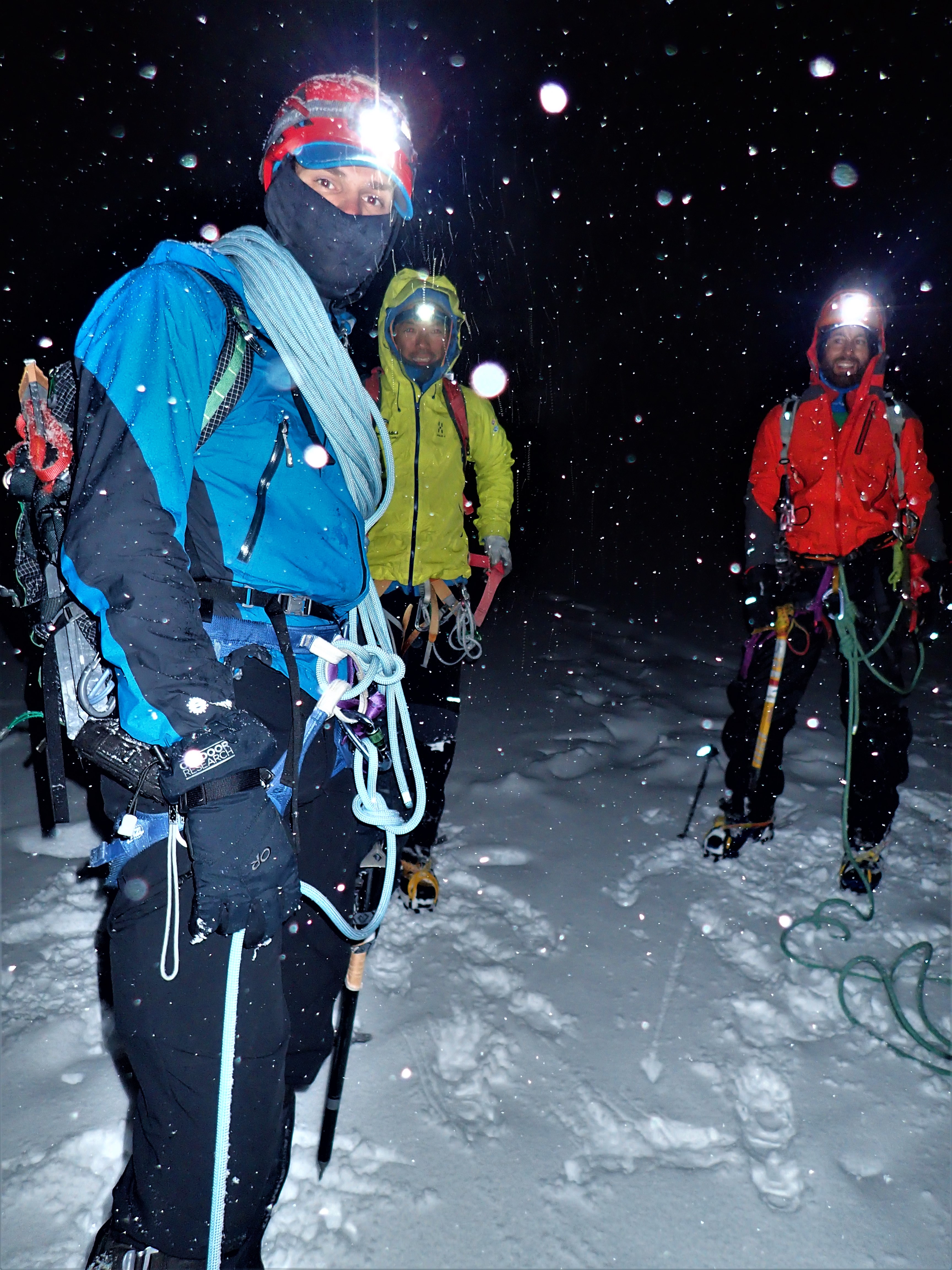
We stood around miserable, ate dinner in the rain. I struggled into my goretex bag and wrestled into sleeping bag and dry thermals. Then through the long night I fretted between searching for down soddening drips and leaks and asphyxiating due to lack of oxygen. Showers persisted through the night. Miraculously I stayed dry and warm and alive and welcomed the relief of morning. More sprinkling rain brought a sleep in.


Day 2

The forecast good day did clear a little so between showers we packed up. EVERYONE had advised us not to go up the Bevan Col route in wet conditions so we headed off on a retreat towards the alternative French Ridge Hut which would give us shelter and a chance to dry out, but use up a valuable extra day.

OLYMPUS DIGITAL CAMERA

Walking down beside the stream within 100 meters of our Bivvy spot we noticed some of the river rocks were drying out. Maybe the notoriously treacherous steep slabby rock would be dry enough to be feasible. So we decided to change the plan and try for the Bevan Col route. 100 meters up the valley we discovered the palatial, dry (compared to a rainy night in a bag) Scott’s Bivvy rock We could have spent a fun, comfy, dry night holed up in the small shelter under the rock and looked out at the passing showers. We lost the track then and struggled and fought through tangled, wet boulder scrub with the really heavy packs (RHPs) for way too long. The food, fuel, warm clothes, too thick rope, rockclimbing gear, my antique heavyweight ice axes etc etc weighed too much. I thought a lot about Sherpas, porters and people of the past with their heavy loads carried into the mountains as I struggled. I thought about how much work and punishment a body, my body, Tom’s body could take before breaking down.

At the “Head of the Valley” we met up with a Canadian couple who had camped for two days waiting for the weather to clear. They somehow exuded mountain competence and experience. Up past the first waterfall all the rock was wet, and steep! The other two started up a low route on a rising traverse of narrow ledges as Tom and I roped up and pitch climbed a section up to and past a bolt, more vertically and closer to the edge of an abyss on the right. The Canadians joined our route and within sight of each other (this leant a significant air of confidence and commeraderie) we decided the rope was unnecessary as there were no real anchors (we didn’t see any more of the abseil route bolts that must have been hidden from us) and the terrain seemed ok. Just! Tussocks and small plants were good to pull up on, the boots edged on small holds and grooves enabled us to balance our loads and teeter upwards as the drop below beckoned with greater height. One section had tricky moves on a ramp overhanging the abyss. Scared. Tenuous. I’d seen a video of a group having an epic descent in heavy rain. They had given up, camped on a small ledge then finally reached the ground next day terrified and drenched. Eventually we made the flat ridge at the top. Flat. Safe. We navigated together then in mist, sharing our info and topo sketches and trying to make sense of the complex terrain. Down a little then up right along a system of slabs which were covered in snow and wet, balancing delicate moves with the RHPs.

The slabs dropped off to the valley floor. After crossing a stream gully we slogged up a steep snow gully, sharing the step making effort. Above a buttress we climbed onto a snow arête and saw the Col only a little higher and further over.

OLYMPUS DIGITAL CAMERA

In a small clearing in the clouds the white summit cap of Aspiring mystically appeared, lit up by the late afternoon sun. As if rewarding us for our effort and risk, and beckoning us on. A moment of clarity and beauty. Our first view of Tititea.

It had taken 6 hours to toil up the 950 meters to the Col. Having roped up we crossed our first crevasse within meters of starting down a snow ramp and then onto the Bonner Glacier.  It seemed to take forever, slowly plodding across the snow and ice. I focussed my mind on looking out for crevasses and tried ridiculously to step lightly. Following the Canadian’s steps was reassuring but no guarantee. At every step I tried to sense the tension in the rope behind leading to Tom, to be ready to instantly throw myself down and dig my boots into the snow so I could hold his fall through into a hidden canyon of ice. This was our first glacier crossing since our mountaineering course. On our own. At the end of a very long day. Stay switched on. Don’t relax. And hope Tom, at the other end of the rope, was doing the same and was ready if I suddenly holed through to thin air underfoot, that he’d hold me dangling by that thread over the icy void.  With RHPs. A final killer 100 meter ascent from the glacier slip sliding up a narrow gully took forever before we reached the rocky domes around the hut. 7.30 pm. Totally spent – physically and mentally.

OLYMPUS DIGITAL CAMERA

The weather cleared. Aspiring/Tititea is a stunningly beautiful mountain. Any ascent from the valley floor is a huge challenge, nothing is gained easily and the fickle weather dictates the terms. Friends have spent weeks hutted and camped nearby only to return home without having stepped on the mountain. We were trying to make the most of the first period of forecast clear weather for the whole summer season (mid Feb) so far. Boots off. Food. Tea. Dinner. Comfort. Shelter. Relief. Rest. Amazingly at 8.30 pm two fellows arrived who had walked in in one 12 hour push – epic!

The Plan – 3 days good weather was forecast – clear, light winds. So far in New Zealand we had only had the occasional good days in amongst atrocious conditions – rain hammering, winds belting. We shared valuable info on possible ways of doing the North West Ridge with the two other pairs. They were on tighter time schedules and aimed to climb the following day. We would trust the weather and have a day to rest and explore to sort out which way we would take, and to familiarise.

To sleep, to sleep, dry and long. My heart seemed still to be thumping as I lay in the moonlit hut – altitude (surely not), dehydration, exertion?

Day 3

The “one day walk inners” left at 4.00am and the Canadians, who turned out to be a mountaineering instructor and an Antarctic remote camp supervisor, departed with more confidence at 7.00am. Later on we followed their tracks up the ISO Glacier and then went on to climb on a nearby smaller peak, the Rolling Pin.

OLYMPUS DIGITAL CAMERA

We returned via the Shipowner Ridge to the hut. Throughout the day Aspiring stood clear and majestic from every vantage point, intimidating, tantalising and always beckoning. Much later than expected we spied both groups near the summit in perfect weather – around 2.30pm. Later still we saw nothing of them. 2 guides arrived with clients who had walked across from the helicopter landing about 2 km away. Then another 2 couples arrived from French Ridge Hut having made it through the Quarterdeck Pass which was normally cut off so late in the summer. Throughout the afternoon I checked on the climbing pairs, seeing nothing, with a growing sense of concern for their safety.

From all our sources of info there seemed to be four main ways to climb the North West Ridge.

  1. The “full” NWR – very long and time consuming on the lower third. And we had already done the  Shipowner Ridge section.
  2. Via the ISO and Therma Glaciers – a quicker way past Shipowner but still slow below the “slab”.
  3. Via the Ramp – a steep snow slope overlaying slabs that bypasses all the rock on the ridge – deemed too dangerous due to avalanche risk so late in the season.
  4. Via the Kangaroo Patch which is a snow slope leading up to the “slab” at 1/3 height.OLYMPUS DIGITAL CAMERA

Late in the day the guides and their clients did a reconnaissance up the Kangaroo Patch, and in the process set a nice set of steps in the steep snow. Based on our own analysis this was also our preferred route. I worried some more about the two climbing parties who were spending so much time on the climb and I considered how remote and isolated they were should anything go wrong.

Tom and I carefully prepared for the next day – lunch, gear, rope coiled and set out, bags packed, clothes laid out, boots and crampons readied. It was reassuring to have time to do all this methodically – for our first big mountain. Just like in our training course we had everything ready for “summit day”. We just hoped the weather gamble would still pay off.

Eventually one party returned at 8.00 pm. They’d had an epic 16 hour day including having to reverse 4 pitches trying unsuccessfully to do a rising traverse on snow across the slopes above the Therma Glacier. The other party returned at 8.30 – 13 1/2 hours. Tom and we’re both thinking that if these parties had taken so long we would be in for a very long day. It was difficult to get to sleep with the buzz in the overfill hut, and to stay asleep later. Keyed up. I drank water through the night top prehydrate.

Day 4

I awoke before the alarm at 2.50 am, lit the stove and woke Tom. Within 15 minutes there were 5 climbing pairs bustling about. Muesli, 2 cups of tea and another drink of water.

Harness on, crampons, backpack, axe, rope. First out the door. A slowly moving set of tiny headlamps followed up the crunchy set of steps under moonlight and a canopy of stars. At 6.00 we reached the slab. At its left edge we climbed a short easy pitch up the ridge as the other parties got going, and then traversed round left onto the open face. The sky lightened a little. Fears of a bottleneck on the rock dissipated as parties climbed around each other on the fairly straightforward rock. Friendly and unhurried, waiting, moving aside, cheery chat. We made up a commeraderie of climbers from Australia, New Zealand, France, Peru and Italy. It was like a day out on a popular crag – on the “Matterhorn of the Southern Alps”, surrounded by now pink tinged snowy peaks and plunging dark valleys and glaciers and snow all around and below. 3 pitches of roped rock climbing on the left hand face (looking up) brought us back onto the ridge proper. I felt at home on the rock – on familiar ground. We were going well. Tom and I moved efficiently together. The practice climbing we’d done was paying off. I laughed and chattered and waved to the other groups nearby.

For a time we simulclimbed the rocky ridge with 20m of rope between us threaded round blocks and through gaps in the rock. On both sides verticality plummeted away to steep snow and ice below the cliffs. The sun goldened the surrounding peaks and ranges. The two guided parties dropped behind and one pair went in front.

OLYMPUS DIGITAL CAMERA

At 8.30 am we reached the “notch”, a low gap between the rocky lower ridge and the snow and ice of the summit section. Morning tea, stash the rock gear and some water for the descent. We removed the rope as the snow looked straightforward and consistent. Without anchors and belays, which would have taken too much time, any slip or mistake by one of us would mean the end for both if we had remained roped together. I remembered a line from my course, “If you’re not attached to the mountain the rope is a danger to you both”. Crampons back on we made our way up.

OLYMPUS DIGITAL CAMERA

Stepped up slowly through the snowfields. As the angle steepened I zigzagged a slow and careful ascent. The ground and snow continued to be fine for well placed steps, driving the side points into the surface for maximum grip. Over near the right edge Where cliffs dropped away I  was able to spy another group on the near vertical ice couloir section of the South West Ridge.

Higher up my mind played tricks with the numbers I had written down as staging points. Tom’s altimeter had us at 2870m which I calculated at about 500m still to go but I could hear whoops and see helmeted heads peering over at us from not very far above. The summit ice steepened but it was still ok for us to safely solo so we made our way up subtle slightly lower angled ramps and then out left a little. And then there it was. 10 m away. The others were taking photos of us as we made the final few steps. I was overcome.

OLYMPUS DIGITAL CAMERA

I had to hug and shake hands with everyone. Reaching a dream that had percolated for forty years happens only rarely. Time and health and loved ones and the world has to come together in a special combination in that one place at that one moment. The world is indeed a wonderful place. Peaks and lakes and glaciers and valleys and ice and snow and rock blazed with light everywhere. In certain moments time and life is concentrated in sublime adventure.

OLYMPUS DIGITAL CAMERA

10.30 am. We photoed and laughed and lunched in perfect windless calm on Tititea’s mountain top. The south west ridge pair appeared to join the merry throng. In a quiet moment Tom and I shook hands in a gesture of thanks to one another for sharing the climb and for making it possible for each other.

Down – switch on again. The ascent is only half the climb. We stepped down the icy sastrugi, slow, measured steps, taking lines that gave the greatest chance of a self arrest should we make a mistake. Minds off the view, eyes locked on feet. Concentrating hard not to tanglefoot or catch a crampon strap. Back at the notch I collected the rock gear. Six of us scrambled back along the narrow rocky ridge together. Awkward moves over the left or right faces or along the actual crest. Up and down. The axes came out for a steep short icy section and the rope for a snow slope protected with an old piton.

OLYMPUS DIGITAL CAMERA

At the base of the steep buttress now 8 of us shared ropes and chatted as we abseiled 4 rapells in happy company together. Then all safely back at the slab we descended at our own pace in pairs roped together against the hidden crevasses in the softer afternoon snow.

Back to the hut. 3.30pm. I was tired but not buggered. The climb had been splendid. Easier and less nerve wracking than anything on the Bevan Col route, which was true to popular legend. All our skills had been brought out, but we had not been pushed out of our comfort zones. Bit by bit, section by section, it had all been OK.

Tea. Boots off. Rest in the warm sun. Inner glow. Food.

A tepid bath in a secluded pond in the rocky knolls nearby – heated by the sun, clean and washed, then lie on the warm stone, naked before the stupendous landscape and the sun. Best bath ever.

The guided parties arrived over dinner. Our thoughts turned to the next stage – getting down to the valley. The Bevan Col route filled us with dread even on dry rock so we opted for French Ridge via the Quarterdeck – in spite of the crevasse stories.

Day 5

OLYMPUS DIGITAL CAMERA

Another up at 4.30am and depart at 5.30 morning. We hoped for firm snow in the cold morning. We plodded back across the Bonner then did a slow climb to the higher part of the glacier between ice falls. The blue ice rose like a silent, slow moving wave in front of us.

OLYMPUS DIGITAL CAMERA

The sun touched the South West face of Aspiring.

OLYMPUS DIGITAL CAMERA

We trudged upwards, the packs a little lighter. A long uphill in the sun and glare took us to the snowy pass of the Quarterdeck which led down to French Ridge and the safety of hiking trails. It’s never over till that lady sings and I couldn’t hear any notes in the breeze. We had also left early to go through the Quarterdeck icefall before the sun softened everything up. So a quick stuff of the face with food and we were off. It was firm and hard still. A little scarey. Down steeply, then across a huge crevasse at the edge of the cliff above Gloomy Gorge, down some more, over (just!) a crevasse with a large foot hole, down, gingerly across then onto a steep section of ice. We front pointed sideways on frozen toe holes from previous climbers. Committed, we continued across then diagonally down.  The ice axe pick dug in deep with each step.  A massive yawning crevasse waited 30 meters of steep ice below. This was much harder than anything on the climb, the course or even Bevan Col. Trust your buddy. Front point down, some more, careful. I could see the bottom. Concentrate. Tom’s crampon came loose. I dug a little stance for myself and tried to ram my axe handle into the ice for an anchor, unsuccessfully. Tom stayed in control, balanced with his pack on, ice axe dug in, and carefully reattached it. Trust. Don’t fall now. Ice screws were in the bottom of the pack, unavailable. The rescue knife that could have cut us free from one another lay forgotten at the back of my harness. We didn’t both have to go. Then down a step at a time. Eventually onto softer then less steeply angled snow and finally to the bottom. Release. Relief. A close call, just in control, there’s a very fine edge between safety and danger sometimes.

Lunch on a sunny rock. A pair of tar scampered over the snow. Valleys. Mountains. Down snow then scree and rock and into alpine grassland. French Ridge Hut. Tea. Views. Keas. Muesli leftovers for a second lunch. Waterfalls tumbled from hanging glaciers everywhere into the valleys. Their constant murmur, a low hum, sounded like it could be the lady’s song at last.

Day 6

Down, down, down. In the dark (it’s a habit now) to reduce the risk of getting stuck in the carpark due to flooded streams from the forecast afternoon rain. Down from the bright red hut. The descent track hugged the edge of the drop into Gorge. Tangled roots provided hand and foot holds. Into the beech forest at last. Careful not to twist a knee or ankle. The stream at the bottom, 900 m below the hut, tumbled and churned glacial green and silver over boulders beside mossed trees. Rest, eat, recuperate.

OLYMPUS DIGITAL CAMERA

Along the valley floor the track wound back in and out of the forest and daisy fields. At regular rest stops we looked back and far above to the mountain top visible above the ice of the Breakaway. High, aloof, imposing, now with a wind blown cloud plume in the deteriorating weather.

OLYMPUS DIGITAL CAMERA

We passed by a variety of people, hikers from across the world, the DOC hut warden off to catch and band robins. And at Aspiring Hut a pair of seasoned climbers, “Aspiring is probably the finest mountain in New Zealand”.

OLYMPUS DIGITAL CAMERA

And a group of exuberant young adults who had mountain biked into the clearing to lunch and rest. A similar age to the students I had worked with for many years I struck up a conversation with a bubbly guy and girl at the table where I was tying up my pack. I learned that they were a group from Mount Aspiring College out on an outdoor trip for the day. “I want to climb Mount Aspiring in 2019. It’s my aim”, the shining young man told us with a determined and hopeful grin while pointing up the valley from where we’ve come. “Good luck and good on you”, I responded and thought ‘may the force be with you and may the lady of the waterfalls sing your safe and exuberant return from the journey’. In this brief interchange I sensed a strong connection through a wrinkle in time, a reflection of my self across the decades and across the wooden bench. A circularity, a sense of completion and renewal. The call and wonder of the mountains.

————————————————————————–

THANKS

Tom – for being on the other end of the rope, for trusting and for sharing every aspect of the journey

Tai – from AGL for all the info so generously shared about the climb and access

NZAC – for providing the forum for Tom and I to connect up

AGL – for the terrific Technical Mountaineering Course which gave us the skills and knowledge and confidence to take it all on (Bill and Tai)

Adventure Consultants and Aspiring Guides in Wanaka for providing even more bits of information

NOTE

Message from daughter on the day we left – “Sorry I missed your call. I was at an African dance class. Hope your adventures are sublime.OLYMPUS DIGITAL CAMERA

OLYMPUS DIGITAL CAMERA

Abridged article in NZAC Australia Section magazine Sept 2017


52 Adventures. That's the aim. One each week. Like any real adventure the outcome is unknown. The journey, the comrades, the solitude, the challenges, the special places are what matters. And this is the record – writing, images and video. Enjoy.